Toggle navigation
Survey Documents
Advanced Search
Supporting Data
Companies
Surveyors
Communities
Original Townships
APIs
Survey Documents API
Tutorial
About
Contact
Search
3214-2
Download lotsplits3214_2.tif
GIS Data
Latitude:
41.0500439999998
Longitude:
-81.541697
Identification
Survey identifier:
3214-2
Context
Original township:
Akron
Community list:
Akron
Surveyed on:
Description
Owner:
Description:
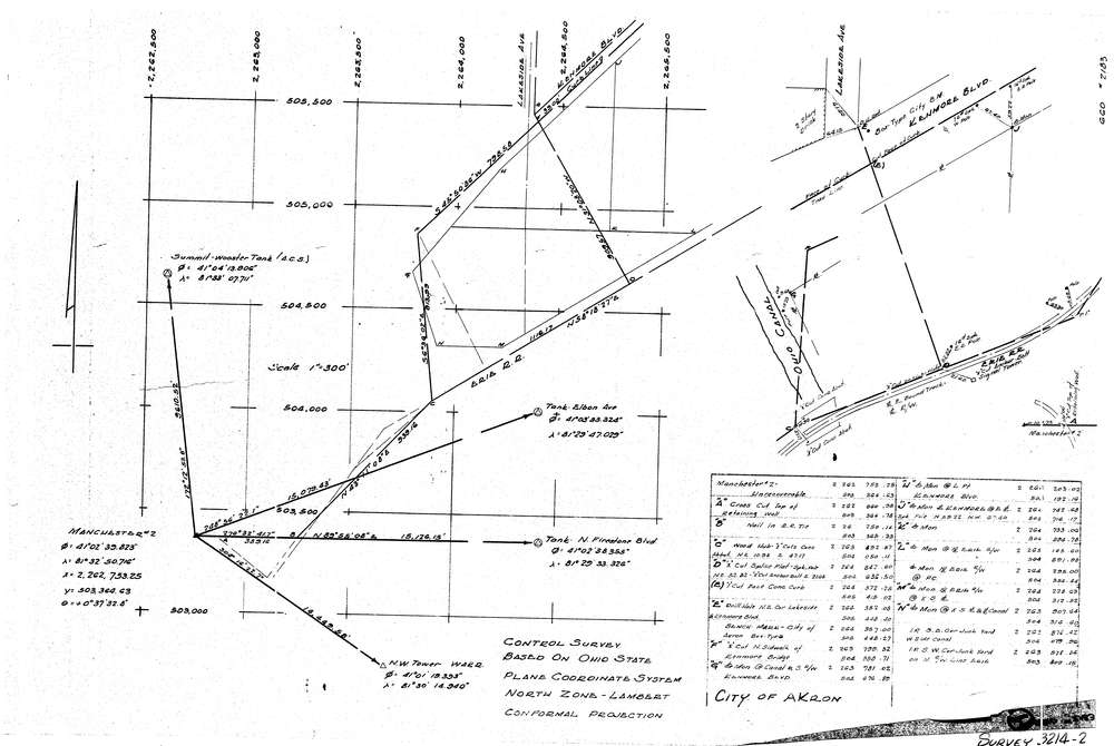
Control Survey On Ohio State Plane Coordinate System
Primary road:
Kenmore Blvd
Secondary road:
Lakeside Ave
Near intersection:
Acreage:
Survey Locators
Tract list:
Lot list:
Section list:
Quarter:
Surveyor
Surveyor number:
Surveyor name:
Company:
Document Data
Scan File Name:
lotsplits3214_2.tif
Scan Pages:
1
Drawer location: