Toggle navigation
Survey Documents
Advanced Search
Supporting Data
Companies
Surveyors
Communities
Original Townships
APIs
Survey Documents API
Tutorial
About
Contact
Search
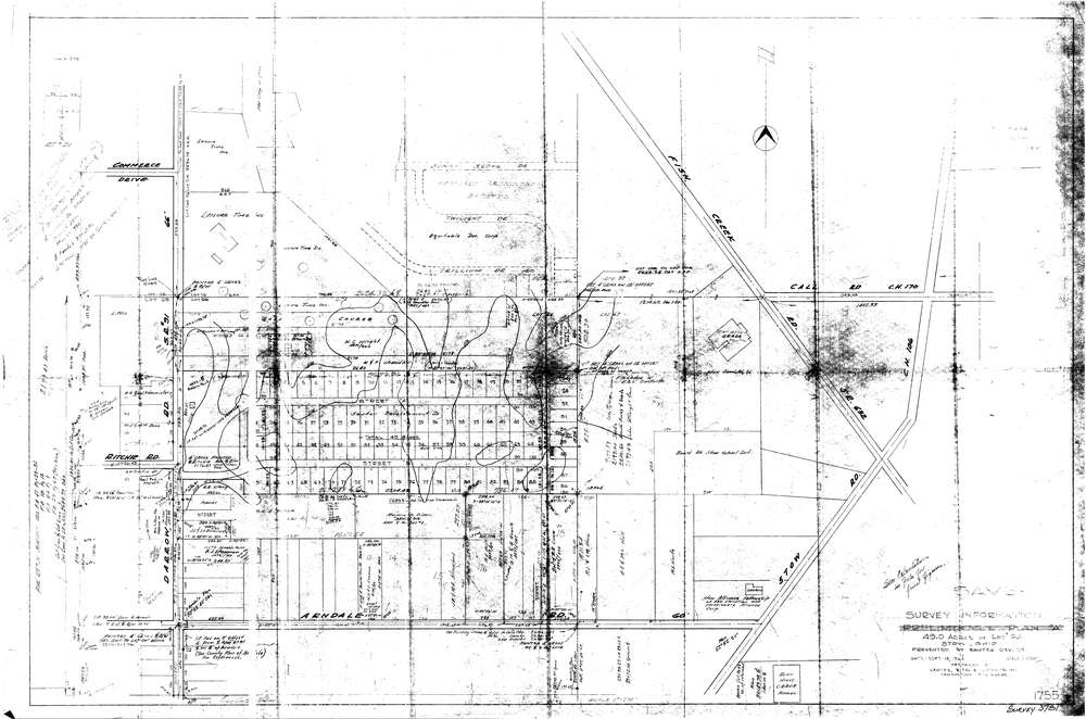
3781
Download lotsplits3781.tif
GIS Data
Latitude:
41.1853719999998
Longitude:
-81.434441
Identification
Survey identifier:
3781
Context
Original township:
Stow
Community list:
Stow
Surveyed on:
09/18/1964
Description
Owner:
Description:
Primary road:
Darrow Rd
Secondary road:
Near intersection:
Arndale Rd
Acreage:
Survey Locators
Tract list:
Lot list:
66
Section list:
Quarter:
Surveyor
Surveyor number:
Surveyor name:
Company:
Sauter Ritchie & Doane Inc.
Document Data
Scan File Name:
lotsplits3781.tif
Scan Pages:
1
Drawer location: