Toggle navigation
Survey Documents
Advanced Search
Supporting Data
Companies
Surveyors
Communities
Original Townships
APIs
Survey Documents API
Tutorial
About
Contact
Search
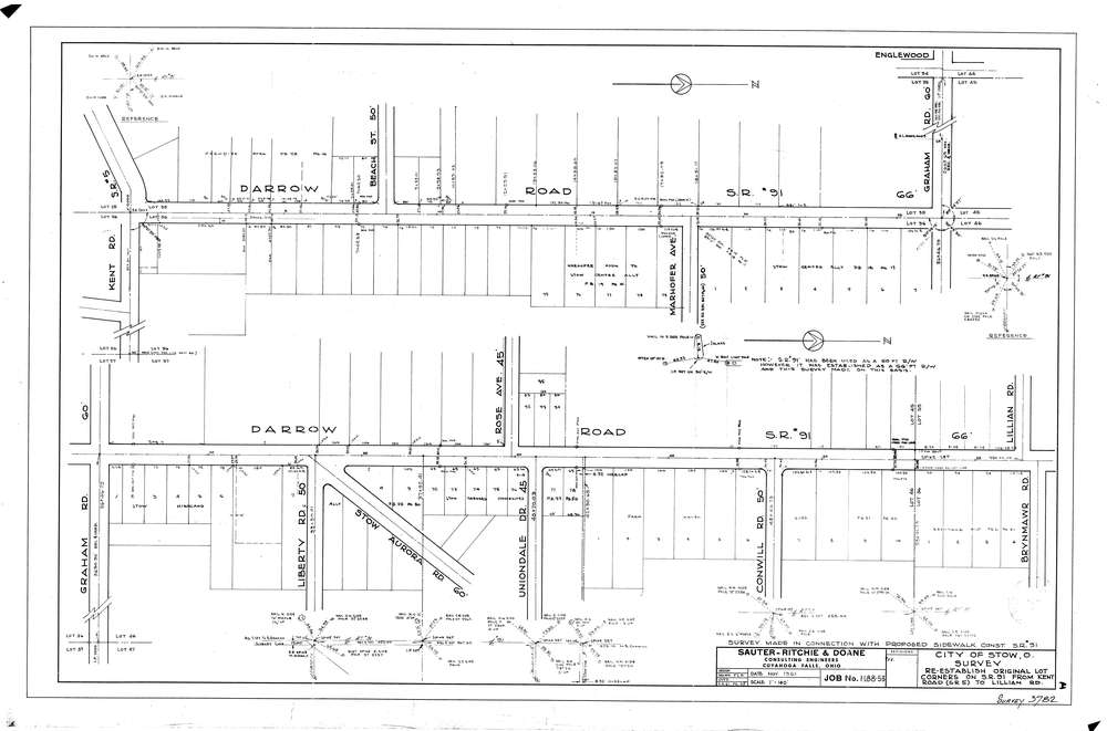
3782
Download lotsplits3782.tif
GIS Data
Latitude:
41.1666849999999
Longitude:
-81.440535
Identification
Survey identifier:
3782
Context
Original township:
Stow
Community list:
Stow
Surveyed on:
11/01/1961
Description
Owner:
Description:
Centerline: Kent road to Lillian road
Primary road:
Darrow Rd
Secondary road:
Near intersection:
Kent, Lillian
Acreage:
Survey Locators
Tract list:
Lot list:
35, 36, 45, 46, 55, 56
Section list:
Quarter:
Surveyor
Surveyor number:
Surveyor name:
Company:
Sauter Ritchie & Doane Inc.
Document Data
Scan File Name:
lotsplits3782.tif
Scan Pages:
1
Drawer location: