Toggle navigation
Survey Documents
Advanced Search
Supporting Data
Companies
Surveyors
Communities
Original Townships
APIs
Survey Documents API
Tutorial
About
Contact
Search
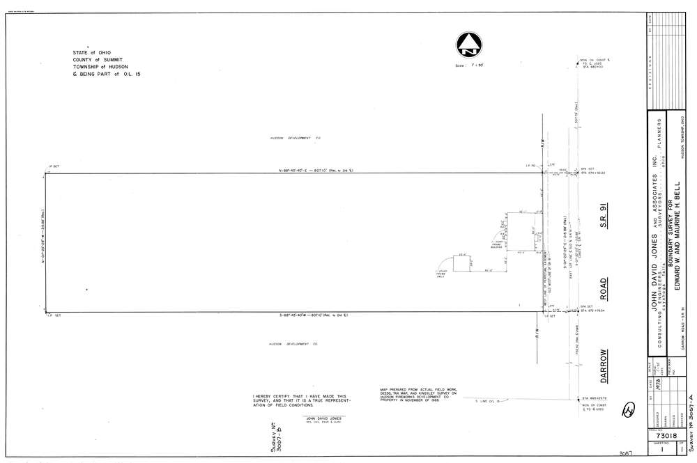
3057
Download lotsplits3057.tif
GIS Data
Latitude:
41.2087999999998
Longitude:
-81.441972
Identification
Survey identifier:
3057
Context
Original township:
Hudson
Community list:
Hudson
Surveyed on:
01/01/1973
Description
Owner:
Bell
Description:
Primary road:
Darrow Rd
Secondary road:
Near intersection:
Norton Rd
Acreage:
Survey Locators
Tract list:
Lot list:
15
Section list:
Quarter:
Surveyor
Surveyor number:
4362
Surveyor name:
Jones, John D.
Company:
The John David Jones Corporation
Document Data
Scan File Name:
lotsplits3057.tif
Scan Pages:
1
Drawer location: