Toggle navigation
Survey Documents
Advanced Search
Supporting Data
Companies
Surveyors
Communities
Original Townships
APIs
Survey Documents API
Tutorial
About
Contact
Search
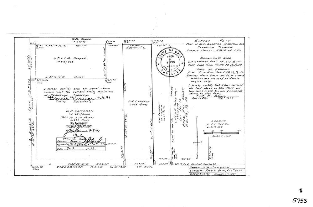
5753
Download lotsplits5753.tif
GIS Data
Latitude:
40.9808117999998
Longitude:
-81.6369873
Identification
Survey identifier:
5753
Context
Original township:
Franklin
Community list:
Franklin
Surveyed on:
08/13/1991
Description
Owner:
Cameron, D.H.
Description:
Primary road:
Vanderhoof Rd
Secondary road:
Near intersection:
Kungle Rd
Acreage:
2.638
Survey Locators
Tract list:
Lot list:
Section list:
7
Quarter:
NE
Surveyor
Surveyor number:
4669
Surveyor name:
Bliss, Fred H.
Company:
Document Data
Scan File Name:
lotsplits5753.tif
Scan Pages:
1
Drawer location: