Toggle navigation
Survey Documents
Advanced Search
Supporting Data
Companies
Surveyors
Communities
Original Townships
APIs
Survey Documents API
Tutorial
About
Contact
Search
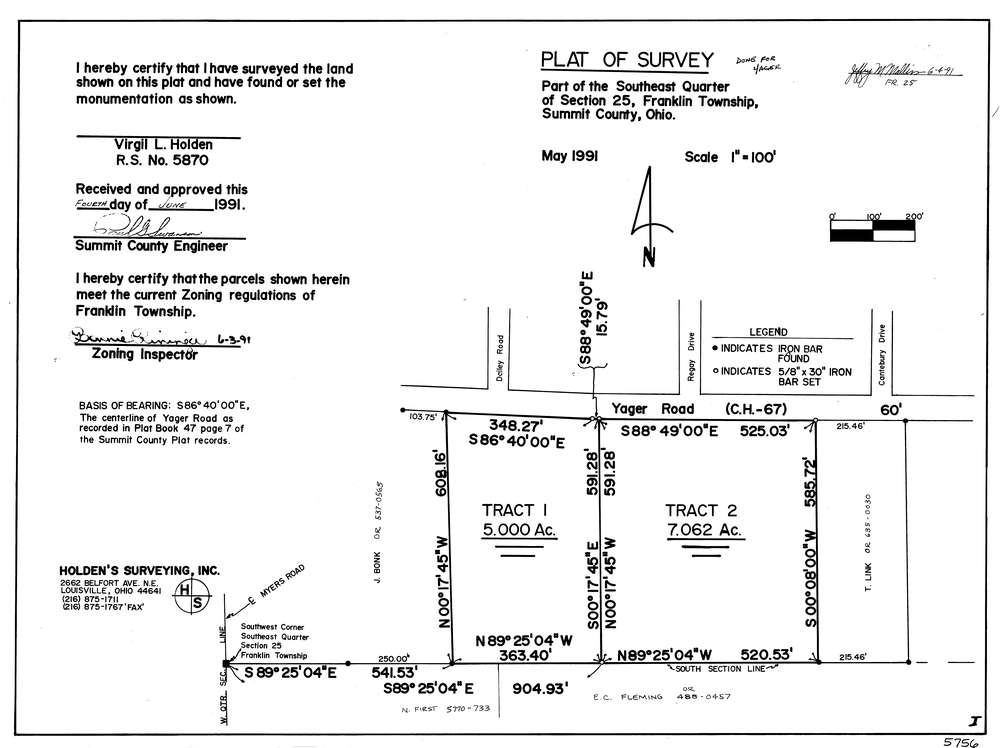
5756
Download lotsplits5756.tif
GIS Data
Latitude:
40.9259936999998
Longitude:
-81.5418273
Identification
Survey identifier:
5756
Context
Original township:
Franklin
Community list:
Franklin
Surveyed on:
05/01/1991
Description
Owner:
Description:
Primary road:
Yager Rd
Secondary road:
Near intersection:
Regay Dr
Acreage:
12.062
Survey Locators
Tract list:
Lot list:
Section list:
25
Quarter:
SE
Surveyor
Surveyor number:
5870
Surveyor name:
Holden, Virgil L.
Company:
Document Data
Scan File Name:
lotsplits5756.tif
Scan Pages:
1
Drawer location: