Toggle navigation
Survey Documents
Advanced Search
Supporting Data
Companies
Surveyors
Communities
Original Townships
APIs
Survey Documents API
Tutorial
About
Contact
Search
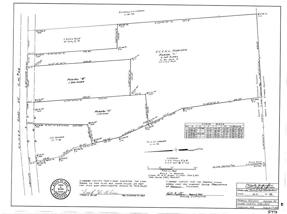
5771
Download lotsplits5771.tif
GIS Data
Latitude:
40.9136321999999
Longitude:
-81.554252
Identification
Survey identifier:
5771
Context
Original township:
Franklin
Community list:
Franklin
Surveyed on:
02/01/1995
Description
Owner:
Harless, T.C. & H.L.
Description:
Primary road:
Comet Rd
Secondary road:
Near intersection:
Manchester Rd
Acreage:
9.2
Survey Locators
Tract list:
Lot list:
Section list:
36
Quarter:
Surveyor
Surveyor number:
4669
Surveyor name:
Bliss, Fred H.
Company:
Document Data
Scan File Name:
lotsplits5771.tif
Scan Pages:
1
Drawer location: