Toggle navigation
Survey Documents
Advanced Search
Supporting Data
Companies
Surveyors
Communities
Original Townships
APIs
Survey Documents API
Tutorial
About
Contact
Search
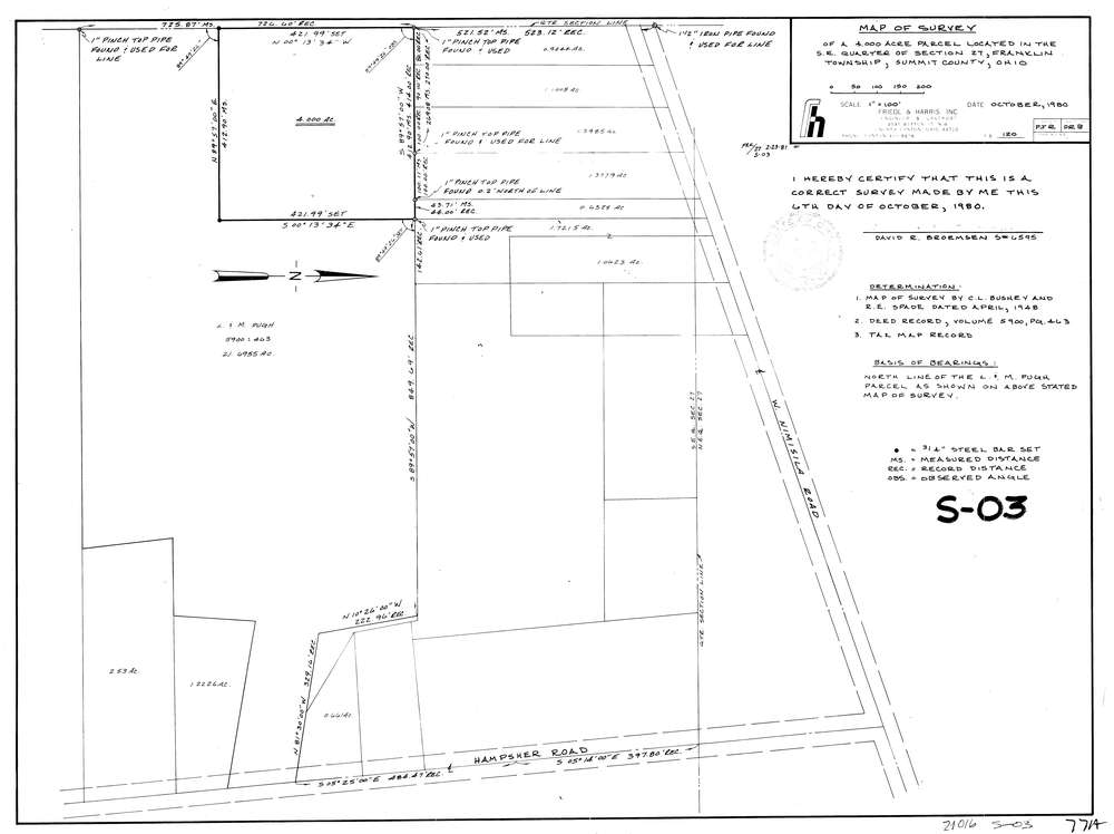
7714
Download lotsplits7714.tif
GIS Data
Latitude:
40.9319598999999
Longitude:
-81.5830217
Identification
Survey identifier:
7714
Context
Original township:
Franklin
Community list:
Franklin
Surveyed on:
10/01/1980
Description
Owner:
Description:
Primary road:
West Nimisila Rd
Secondary road:
Near intersection:
Hampsher Rd
Acreage:
4.0
Survey Locators
Tract list:
Lot list:
Section list:
27
Quarter:
Surveyor
Surveyor number:
6595
Surveyor name:
Broemsen, David R.
Company:
Document Data
Scan File Name:
lotsplits7714.tif
Scan Pages:
1
Drawer location: