Toggle navigation
Survey Documents
Advanced Search
Supporting Data
Companies
Surveyors
Communities
Original Townships
APIs
Survey Documents API
Tutorial
About
Contact
Search
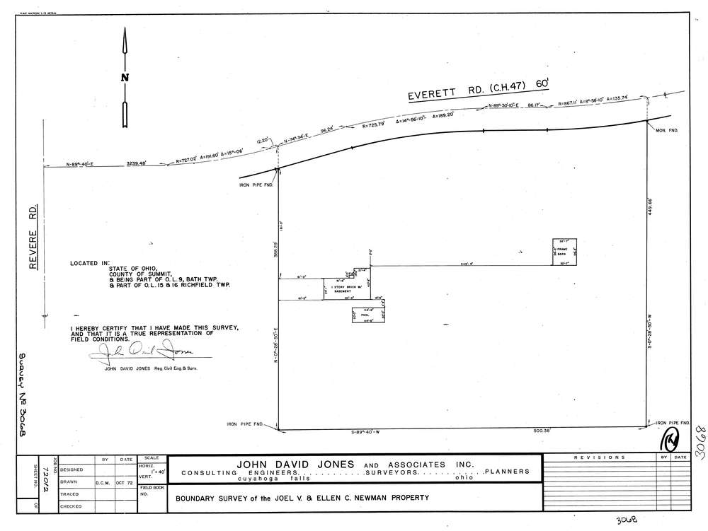
3068
Download lotsplits3068.tif
GIS Data
Latitude:
41.2020679999998
Longitude:
-81.614385
Identification
Survey identifier:
3068
Context
Original township:
Bath
Community list:
Bath
Surveyed on:
10/01/1972
Description
Owner:
Newman
Description:
Also In Richfield O.L. 15 & 16
Primary road:
Everett Rd
Secondary road:
Near intersection:
Revere Rd
Acreage:
Survey Locators
Tract list:
Lot list:
9
Section list:
Quarter:
Surveyor
Surveyor number:
4362
Surveyor name:
Jones, John D.
Company:
The John David Jones Corporation
Document Data
Scan File Name:
lotsplits3068.tif
Scan Pages:
1
Drawer location: