Toggle navigation
Survey Documents
Advanced Search
Supporting Data
Companies
Surveyors
Communities
Original Townships
APIs
Survey Documents API
Tutorial
About
Contact
Search
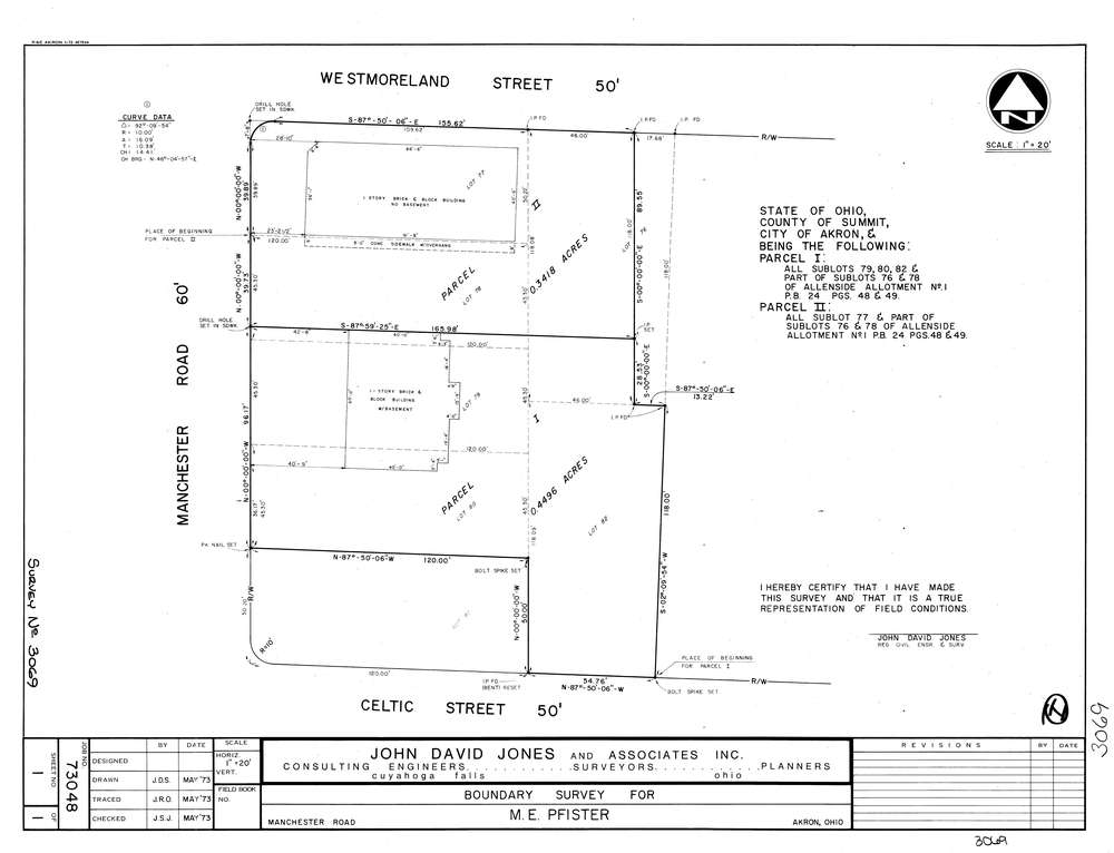
3069
Download lotsplits3069.tif
GIS Data
Latitude:
41.0357129999998
Longitude:
-81.54469
Identification
Survey identifier:
3069
Context
Original township:
Coventry
Community list:
Akron
Surveyed on:
05/01/1973
Description
Owner:
Pfister
Description:
Allenside Allt. P.B. 24 Pg. 48 49
Primary road:
Manchester Rd
Secondary road:
Westmoreland St
Near intersection:
Celtic St
Acreage:
Survey Locators
Tract list:
Lot list:
Section list:
Quarter:
Surveyor
Surveyor number:
4362
Surveyor name:
Jones, John D.
Company:
The John David Jones Corporation
Document Data
Scan File Name:
lotsplits3069.tif
Scan Pages:
1
Drawer location: