Toggle navigation
Survey Documents
Advanced Search
Supporting Data
Companies
Surveyors
Communities
Original Townships
APIs
Survey Documents API
Tutorial
About
Contact
Search
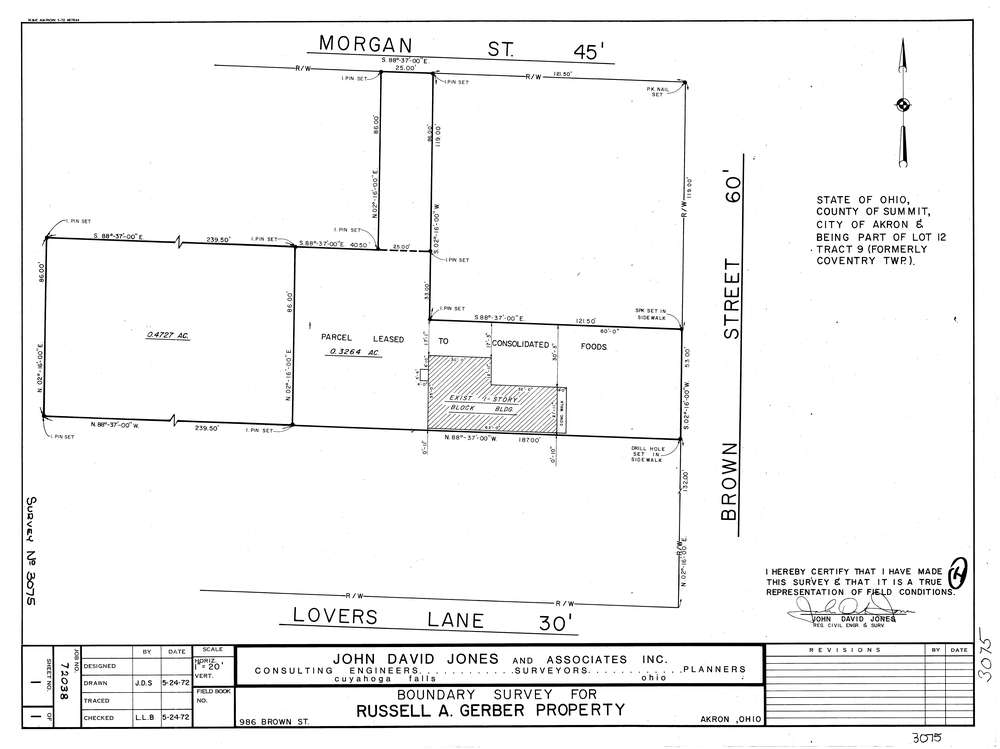
3075
Download lotsplits3075.tif
GIS Data
Latitude:
41.0548419999999
Longitude:
-81.510723
Identification
Survey identifier:
3075
Context
Original township:
Coventry
Community list:
Akron
Surveyed on:
05/24/1972
Description
Owner:
Gerber
Description:
Primary road:
Brown St
Secondary road:
Morgan St
Near intersection:
Lovers Ln
Acreage:
0.7991
Survey Locators
Tract list:
9
Lot list:
12
Section list:
Quarter:
Surveyor
Surveyor number:
4362
Surveyor name:
Jones, John D.
Company:
The John David Jones Corporation
Document Data
Scan File Name:
lotsplits3075.tif
Scan Pages:
1
Drawer location: