Toggle navigation
Survey Documents
Advanced Search
Supporting Data
Companies
Surveyors
Communities
Original Townships
APIs
Survey Documents API
Tutorial
About
Contact
Search
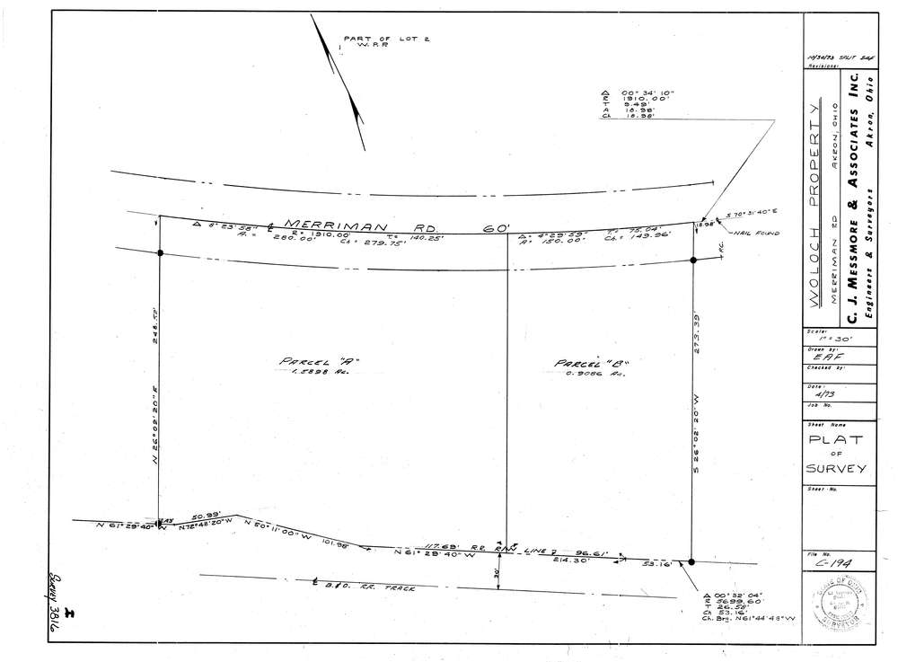
3816
Download lotsplits3816.tif
GIS Data
Latitude:
41.1354049999998
Longitude:
-81.556041
Identification
Survey identifier:
3816
Context
Original township:
Akron
Community list:
Akron
Surveyed on:
07/01/1973
Description
Owner:
Woloch
Description:
Primary road:
Merriman Rd
Secondary road:
Near intersection:
N. Portage Path
Acreage:
2.5
Survey Locators
Tract list:
Lot list:
Section list:
Quarter:
Surveyor
Surveyor number:
5415
Surveyor name:
Fay, Edward A.
Company:
C.J. Messmore & Associates
Document Data
Scan File Name:
lotsplits3816.tif
Scan Pages:
1
Drawer location: