Toggle navigation
Survey Documents
Advanced Search
Supporting Data
Companies
Surveyors
Communities
Original Townships
APIs
Survey Documents API
Tutorial
About
Contact
Search
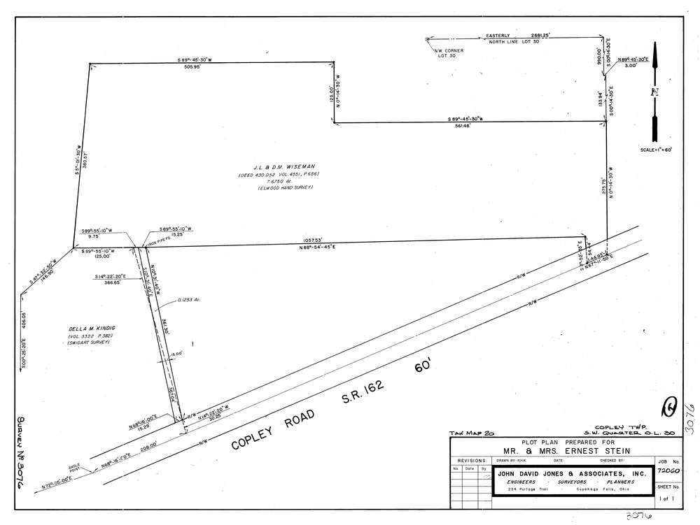
3076
Download lotsplits3076.tif
GIS Data
Latitude:
41.0952979999999
Longitude:
-81.680946
Identification
Survey identifier:
3076
Context
Original township:
Copley
Community list:
Copley
Surveyed on:
01/01/1973
Description
Owner:
Stein
Description:
S.W. Quarter Of Lot 30
Primary road:
Copley Rd
Secondary road:
Near intersection:
Acreage:
7.675
Survey Locators
Tract list:
Lot list:
30
Section list:
Quarter:
SW
Surveyor
Surveyor number:
4362
Surveyor name:
Jones, John D.
Company:
The John David Jones Corporation
Document Data
Scan File Name:
lotsplits3076.tif
Scan Pages:
1
Drawer location: