Toggle navigation
Survey Documents
Advanced Search
Supporting Data
Companies
Surveyors
Communities
Original Townships
APIs
Survey Documents API
Tutorial
About
Contact
Search
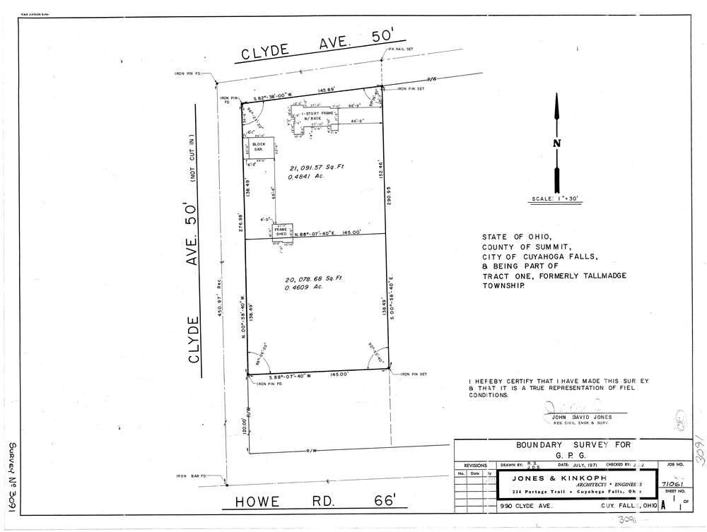
3091
Download lotsplits3091.tif
GIS Data
Latitude:
41.1200989999998
Longitude:
-81.471283
Identification
Survey identifier:
3091
Context
Original township:
Tallmadge
Community list:
Cuyahoga Falls
Surveyed on:
07/01/1971
Description
Owner:
G P G
Description:
990 Clyde Ave
Primary road:
Clyde Ave
Secondary road:
Near intersection:
Howe Rd
Acreage:
0.945
Survey Locators
Tract list:
1
Lot list:
Section list:
Quarter:
Surveyor
Surveyor number:
4362
Surveyor name:
Jones, John D.
Company:
Jones & Kinkoph
Document Data
Scan File Name:
lotsplits3091.tif
Scan Pages:
1
Drawer location: