Toggle navigation
Survey Documents
Advanced Search
Supporting Data
Companies
Surveyors
Communities
Original Townships
APIs
Survey Documents API
Tutorial
About
Contact
Search
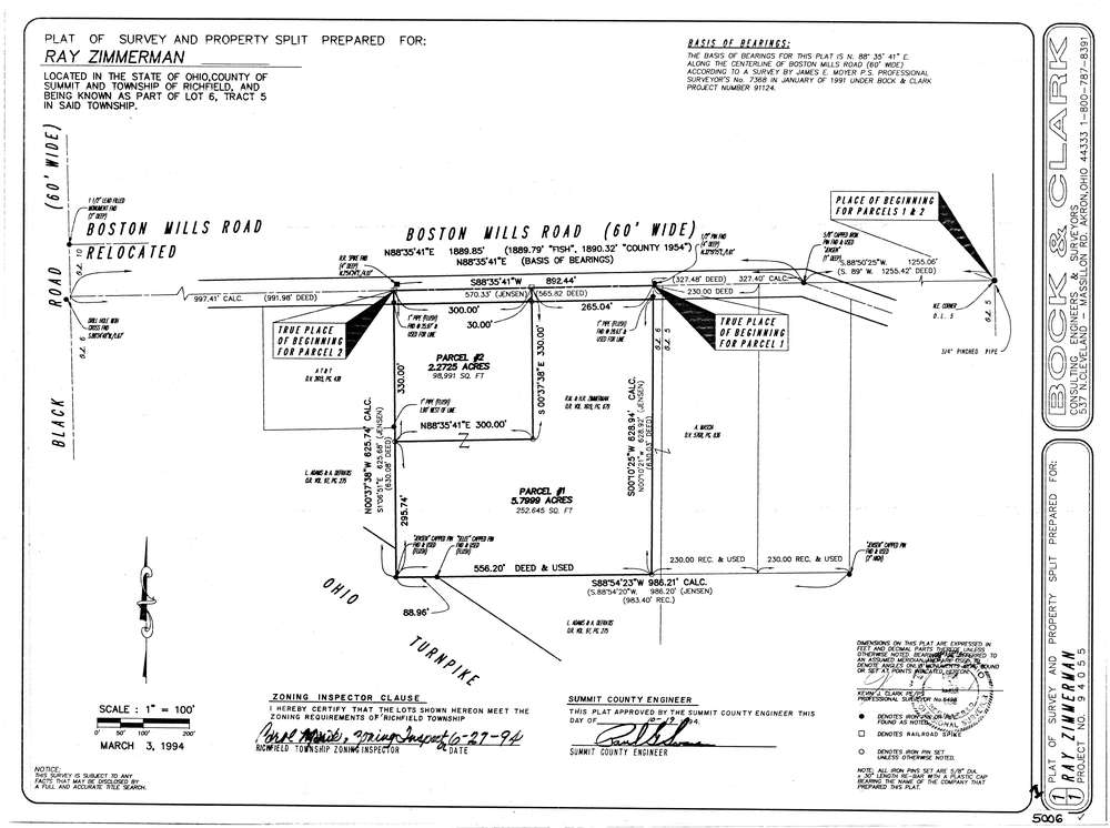
5006
Download lotsplits5006.tif
GIS Data
Latitude:
41.2612072999999
Longitude:
-81.6039466
Identification
Survey identifier:
5006
Context
Original township:
Richfield
Community list:
Richfield
Surveyed on:
03/03/1994
Description
Owner:
Zimmerman
Description:
Parcel #1 = 5.7999 & Parcel #2 = 2.2725
Primary road:
Boston Mills Rd
Secondary road:
Near intersection:
Black Rd
Acreage:
8.0724
Survey Locators
Tract list:
5
Lot list:
6
Section list:
Quarter:
Surveyor
Surveyor number:
6498
Surveyor name:
Clark, Kevin J.
Company:
Bock & Clark
Document Data
Scan File Name:
lotsplits5006.tif
Scan Pages:
1
Drawer location: