Toggle navigation
Survey Documents
Advanced Search
Supporting Data
Companies
Surveyors
Communities
Original Townships
APIs
Survey Documents API
Tutorial
About
Contact
Search
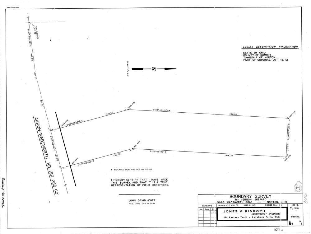
3096
Download lotsplits3096.tif
GIS Data
Latitude:
41.0487089999999
Longitude:
-81.672149
Identification
Survey identifier:
3096
Context
Original township:
Norton
Community list:
Norton
Surveyed on:
12/01/1971
Description
Owner:
Shepard
Description:
3993 Wadsworth Rd
Primary road:
Wadsworth Rd
Secondary road:
Near intersection:
Acreage:
Survey Locators
Tract list:
Lot list:
12
Section list:
Quarter:
Surveyor
Surveyor number:
4362
Surveyor name:
Jones, John D.
Company:
Jones & Kinkoph
Document Data
Scan File Name:
lotsplits3096.tif
Scan Pages:
1
Drawer location: