Toggle navigation
Survey Documents
Advanced Search
Supporting Data
Companies
Surveyors
Communities
Original Townships
APIs
Survey Documents API
Tutorial
About
Contact
Search
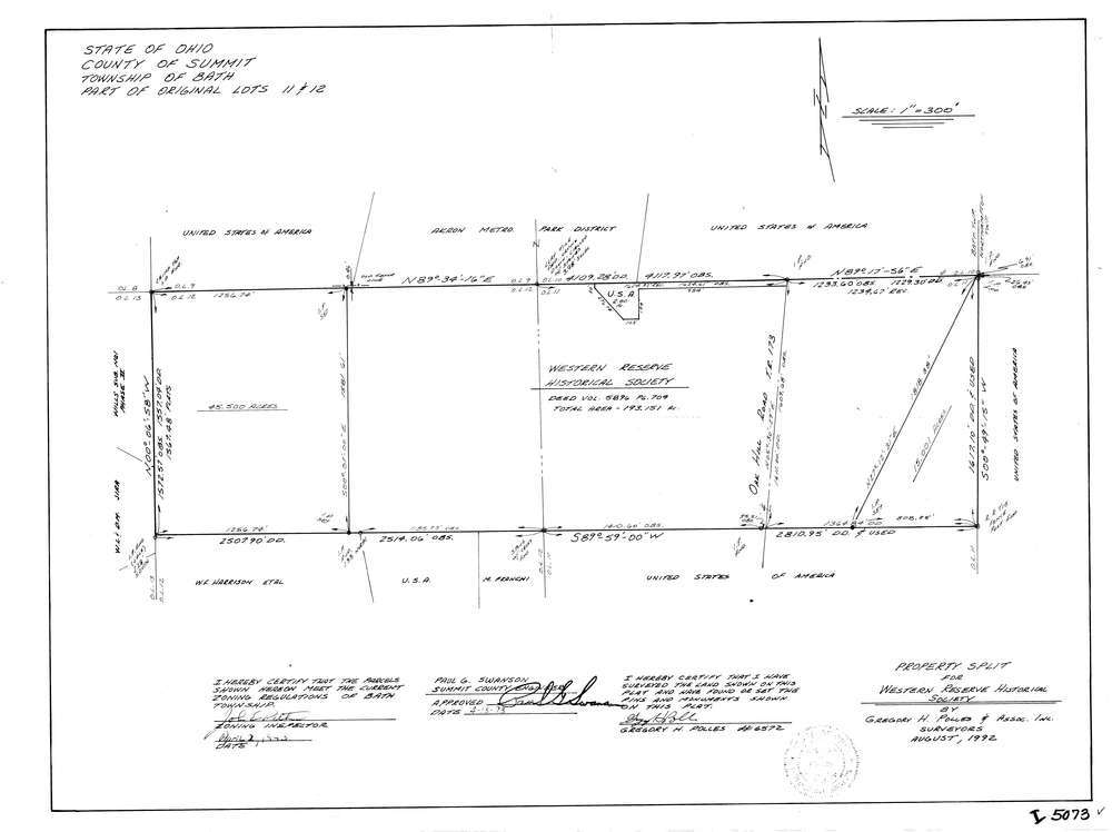
5073
Download lotsplits5073.tif
GIS Data
Latitude:
41.1936998999998
Longitude:
-81.5883599
Identification
Survey identifier:
5073
Context
Original township:
Bath
Community list:
Bath
Surveyed on:
08/01/1992
Description
Owner:
Western Reserve Historical Society
Description:
Primary road:
Oak Hill Rd
Secondary road:
Near intersection:
Acreage:
253.5
Survey Locators
Tract list:
Lot list:
11, 12
Section list:
Quarter:
Surveyor
Surveyor number:
6572
Surveyor name:
Polles, Gregory H.
Company:
The John David Jones Corporation
Document Data
Scan File Name:
lotsplits5073.tif
Scan Pages:
1
Drawer location: