Toggle navigation
Survey Documents
Advanced Search
Supporting Data
Companies
Surveyors
Communities
Original Townships
APIs
Survey Documents API
Tutorial
About
Contact
Search
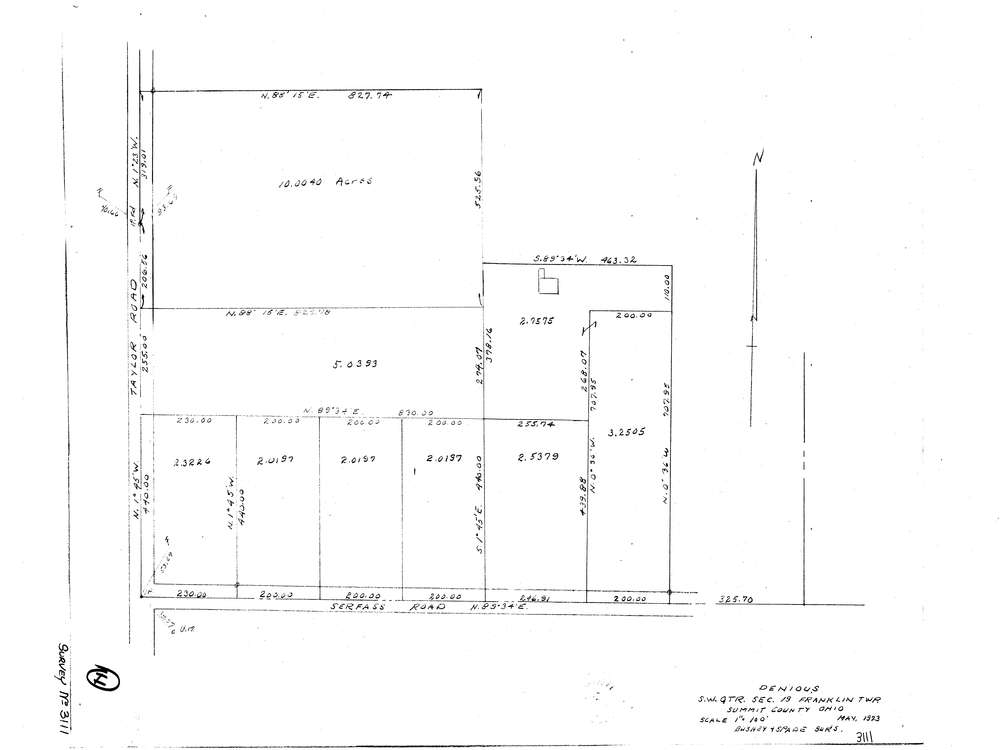
3111
Download lotsplits3111.tif
GIS Data
Latitude:
40.9444449999999
Longitude:
-81.64582
Identification
Survey identifier:
3111
Context
Original township:
Franklin
Community list:
Franklin
Surveyed on:
05/01/2023
Description
Owner:
Denious
Description:
Primary road:
Taylor Rd
Secondary road:
Near intersection:
Serfass Rd
Acreage:
31.0
Survey Locators
Tract list:
Lot list:
Section list:
19
Quarter:
Surveyor
Surveyor number:
Surveyor name:
Company:
Bushey & Spade Surveyors
Document Data
Scan File Name:
lotsplits3111.tif
Scan Pages:
1
Drawer location: