Toggle navigation
Survey Documents
Advanced Search
Supporting Data
Companies
Surveyors
Communities
Original Townships
APIs
Survey Documents API
Tutorial
About
Contact
Search
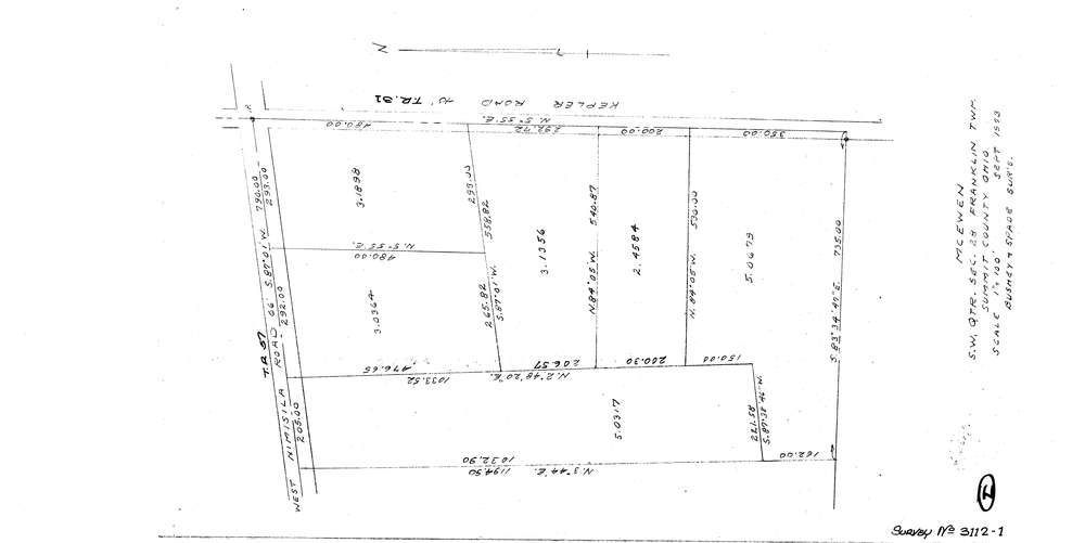
3112-1
Download lotsplits3112_1.tif
GIS Data
Latitude:
40.9302119999998
Longitude:
-81.604729
Identification
Survey identifier:
3112-1
Context
Original township:
Franklin
Community list:
Franklin
Surveyed on:
09/01/1973
Description
Owner:
Mcewen
Description:
Primary road:
Kepler Rd
Secondary road:
Near intersection:
Nimisila Rd
Acreage:
Survey Locators
Tract list:
Lot list:
Section list:
28
Quarter:
SW
Surveyor
Surveyor number:
Surveyor name:
Company:
Bushey & Spade Surveyors
Document Data
Scan File Name:
lotsplits3112_1.tif
Scan Pages:
1
Drawer location: