Toggle navigation
Survey Documents
Advanced Search
Supporting Data
Companies
Surveyors
Communities
Original Townships
APIs
Survey Documents API
Tutorial
About
Contact
Search
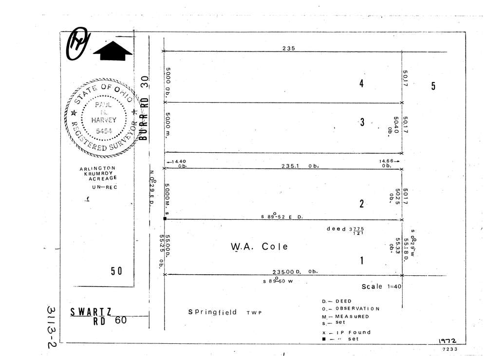
3113-2
Download lotsplits3113_2.tif
GIS Data
Latitude:
41.0181739999999
Longitude:
-81.48478
Identification
Survey identifier:
3113-2
Context
Original township:
Springfield
Community list:
Springfield
Surveyed on:
01/01/1972
Description
Owner:
Cole
Description:
Primary road:
Burr Rd
Secondary road:
Near intersection:
Swartz Rd
Acreage:
Survey Locators
Tract list:
Lot list:
Section list:
Quarter:
Surveyor
Surveyor number:
5454
Surveyor name:
Harvey Paul M.
Company:
Document Data
Scan File Name:
lotsplits3113_2.tif
Scan Pages:
1
Drawer location: