Toggle navigation
Survey Documents
Advanced Search
Supporting Data
Companies
Surveyors
Communities
Original Townships
APIs
Survey Documents API
Tutorial
About
Contact
Search
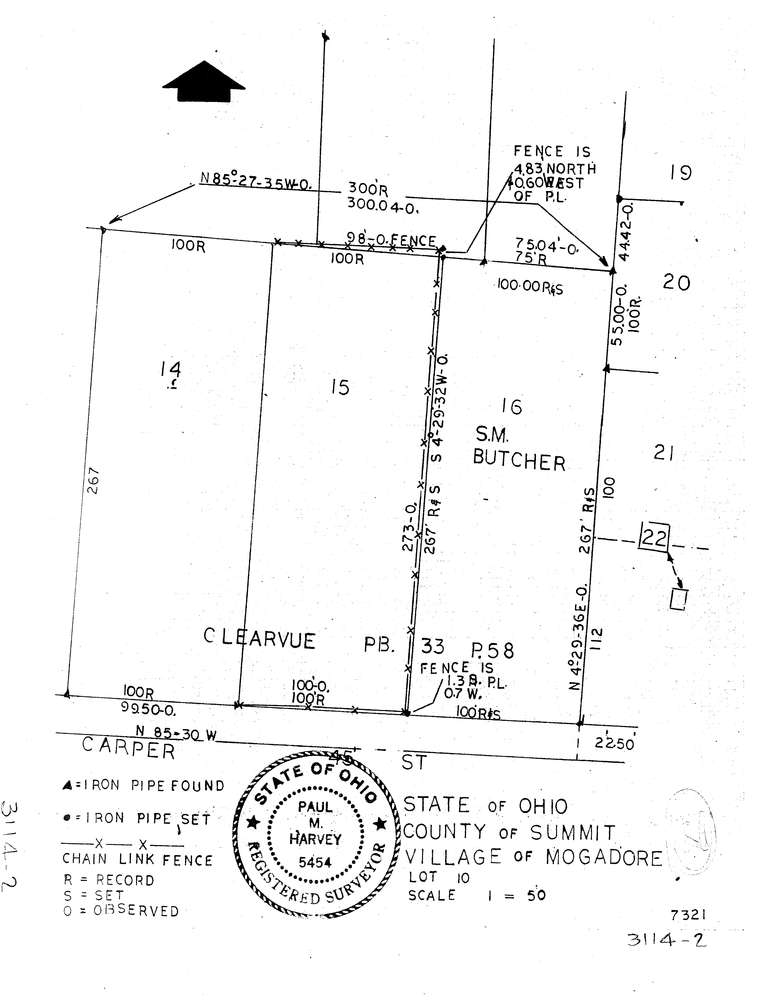
3114-2
Download lotsplits3114_2.tif
GIS Data
Latitude:
41.0387839999998
Longitude:
-81.394883
Identification
Survey identifier:
3114-2
Context
Original township:
Springfield
Community list:
Mogadore
Surveyed on:
Description
Owner:
Butcher
Description:
Primary road:
Carper St
Secondary road:
Near intersection:
Acreage:
Survey Locators
Tract list:
Lot list:
10
Section list:
Quarter:
Surveyor
Surveyor number:
5454
Surveyor name:
Harvey Paul M.
Company:
Document Data
Scan File Name:
lotsplits3114_2.tif
Scan Pages:
1
Drawer location: