Toggle navigation
Survey Documents
Advanced Search
Supporting Data
Companies
Surveyors
Communities
Original Townships
APIs
Survey Documents API
Tutorial
About
Contact
Search
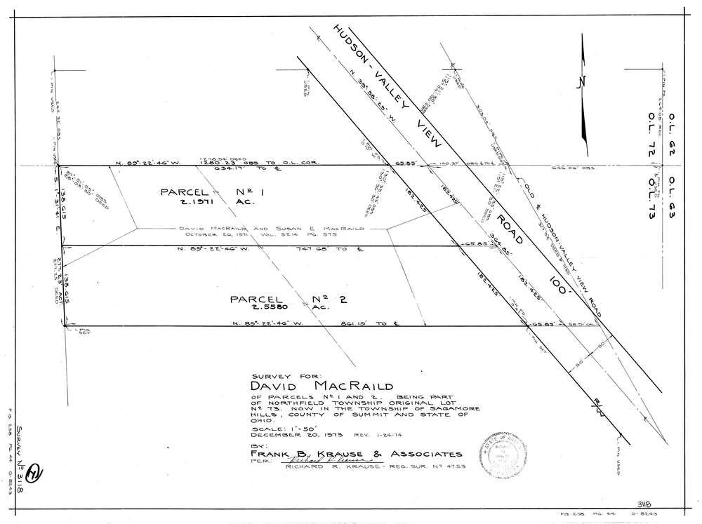
3118
Download lotsplits3118.tif
GIS Data
Latitude:
41.3360589999999
Longitude:
-81.561942
Identification
Survey identifier:
3118
Context
Original township:
Northfield
Community list:
Northfield
Surveyed on:
12/20/1973
Description
Owner:
Macraild
Description:
Primary road:
Valley View Rd
Secondary road:
Near intersection:
Dunham Rd
Acreage:
4.7
Survey Locators
Tract list:
Lot list:
73
Section list:
Quarter:
Surveyor
Surveyor number:
4753
Surveyor name:
Krause, Richard R.
Company:
Document Data
Scan File Name:
lotsplits3118.tif
Scan Pages:
1
Drawer location: