Toggle navigation
Survey Documents
Advanced Search
Supporting Data
Companies
Surveyors
Communities
Original Townships
APIs
Survey Documents API
Tutorial
About
Contact
Search
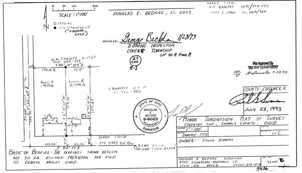
5436
Download lotsplits5436.tif
GIS Data
Latitude:
40.9890073999998
Longitude:
-81.5069137
Identification
Survey identifier:
5436
Context
Original township:
Coventry
Community list:
Coventry
Surveyed on:
01/01/1993
Description
Owner:
Kanipes
Description:
Primary road:
Jarvis Rd
Secondary road:
Jasmine St
Near intersection:
Acreage:
2.3984
Survey Locators
Tract list:
Lot list:
Section list:
Quarter:
Surveyor
Surveyor number:
6023
Surveyor name:
Bedore, Douglas E.
Company:
Bedore Surveying
Document Data
Scan File Name:
lotsplits5436.tif
Scan Pages:
1
Drawer location: