Toggle navigation
Survey Documents
Advanced Search
Supporting Data
Companies
Surveyors
Communities
Original Townships
APIs
Survey Documents API
Tutorial
About
Contact
Search
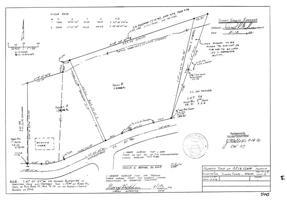
5445
Download lotsplits5445.tif
GIS Data
Latitude:
41.0205119999998
Longitude:
-81.5537556
Identification
Survey identifier:
5445
Context
Original township:
Coventry
Community list:
Coventry
Surveyed on:
11/03/1991
Description
Owner:
Clapp
Description:
Primary road:
Woodsfield Dr
Secondary road:
Near intersection:
Acreage:
3.5712
Survey Locators
Tract list:
15
Lot list:
5
Section list:
Quarter:
Surveyor
Surveyor number:
6023
Surveyor name:
Bedore, Douglas E.
Company:
Bedore Surveying
Document Data
Scan File Name:
lotsplits5445.tif
Scan Pages:
1
Drawer location: