Toggle navigation
Survey Documents
Advanced Search
Supporting Data
Companies
Surveyors
Communities
Original Townships
APIs
Survey Documents API
Tutorial
About
Contact
Search
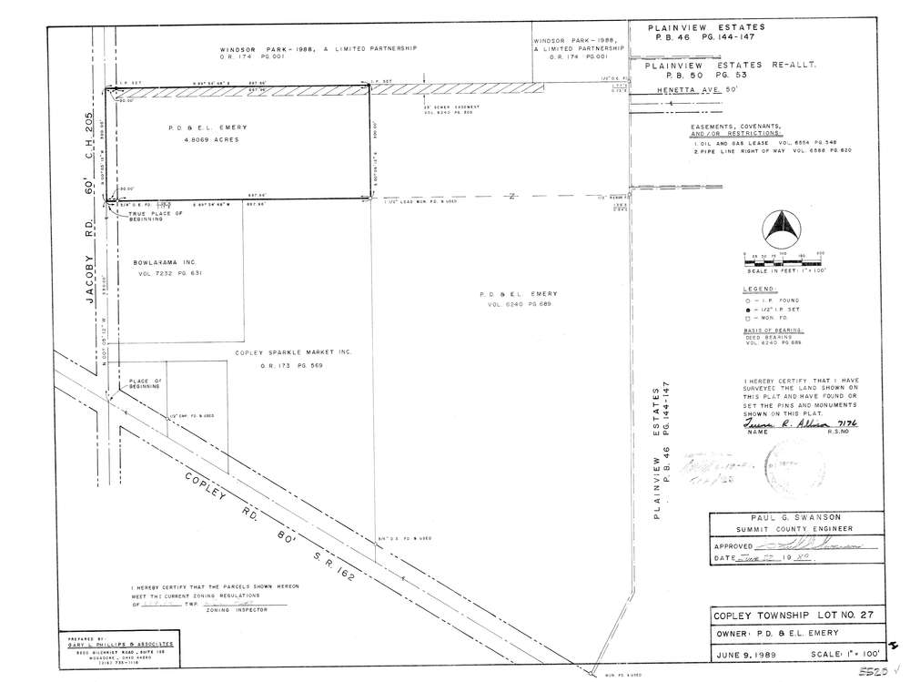
5520
Download lotsplits5520.tif
GIS Data
Latitude:
41.0951811999999
Longitude:
-81.6180954
Identification
Survey identifier:
5520
Context
Original township:
Copley
Community list:
Copley
Surveyed on:
06/09/1989
Description
Owner:
Emery
Description:
Primary road:
Jacoby Rd
Secondary road:
Near intersection:
Copley Rd
Acreage:
4.8069
Survey Locators
Tract list:
Lot list:
27
Section list:
Quarter:
Surveyor
Surveyor number:
7176
Surveyor name:
Allison, Terence R.
Company:
Gary L. Phillips & Associates
Document Data
Scan File Name:
lotsplits5520.tif
Scan Pages:
1
Drawer location: