Toggle navigation
Survey Documents
Advanced Search
Supporting Data
Companies
Surveyors
Communities
Original Townships
APIs
Survey Documents API
Tutorial
About
Contact
Search
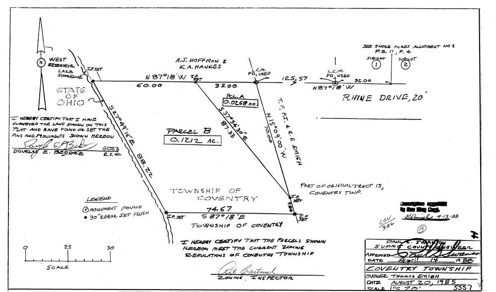
5557
Download lotsplits5557.tif
GIS Data
Latitude:
40.9901375999998
Longitude:
-81.5366308
Identification
Survey identifier:
5557
Context
Original township:
Coventry
Community list:
Coventry
Surveyed on:
08/20/1985
Description
Owner:
Emigh. Thomas
Description:
Primary road:
Rhine Dr
Secondary road:
Near intersection:
Acreage:
0.148
Survey Locators
Tract list:
13
Lot list:
Section list:
Quarter:
Surveyor
Surveyor number:
6023
Surveyor name:
Bedore, Douglas E.
Company:
Bedore Surveying
Document Data
Scan File Name:
lotsplits5557.tif
Scan Pages:
1
Drawer location: