Toggle navigation
Survey Documents
Advanced Search
Supporting Data
Companies
Surveyors
Communities
Original Townships
APIs
Survey Documents API
Tutorial
About
Contact
Search
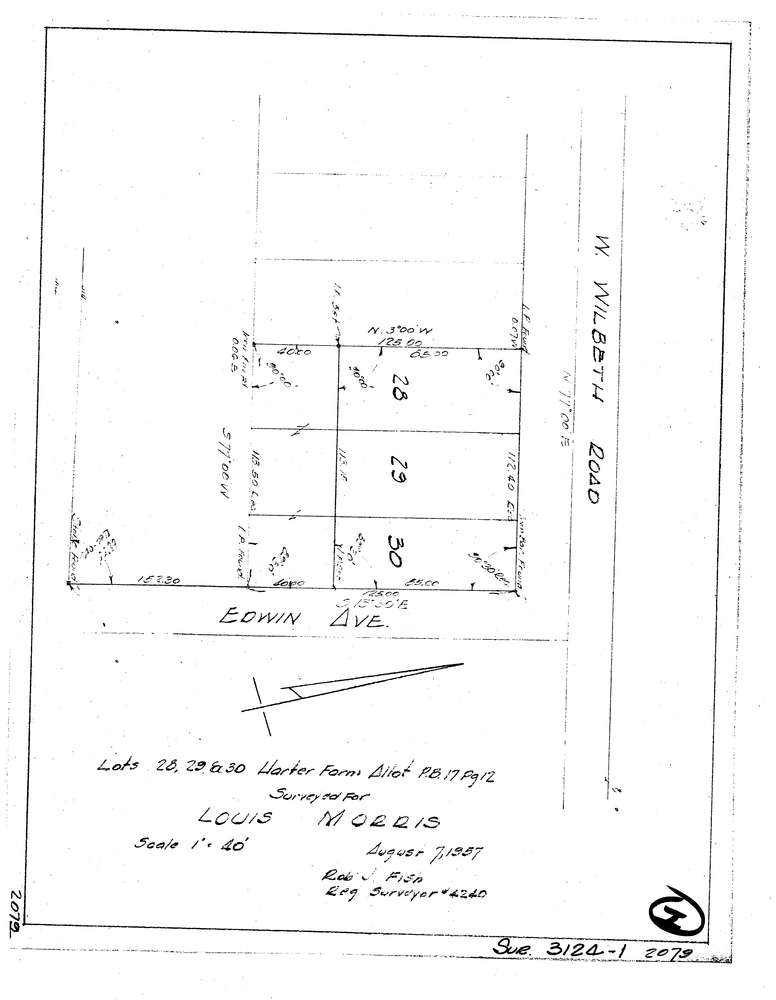
3124-1
Download lotsplits3124_1.tif
GIS Data
Latitude:
41.0395249999998
Longitude:
-81.542641
Identification
Survey identifier:
3124-1
Context
Original township:
Akron
Community list:
Akron
Surveyed on:
Description
Owner:
Morris
Description:
Lots 28,29 30 Harter Farm Allotment
Primary road:
Wilbeth Rd
Secondary road:
Edwin Ave
Near intersection:
Acreage:
Survey Locators
Tract list:
Lot list:
Section list:
Quarter:
Surveyor
Surveyor number:
4240
Surveyor name:
Fish, Robert J.
Company:
Document Data
Scan File Name:
lotsplits3124_1.tif
Scan Pages:
1
Drawer location: