Toggle navigation
Survey Documents
Advanced Search
Supporting Data
Companies
Surveyors
Communities
Original Townships
APIs
Survey Documents API
Tutorial
About
Contact
Search
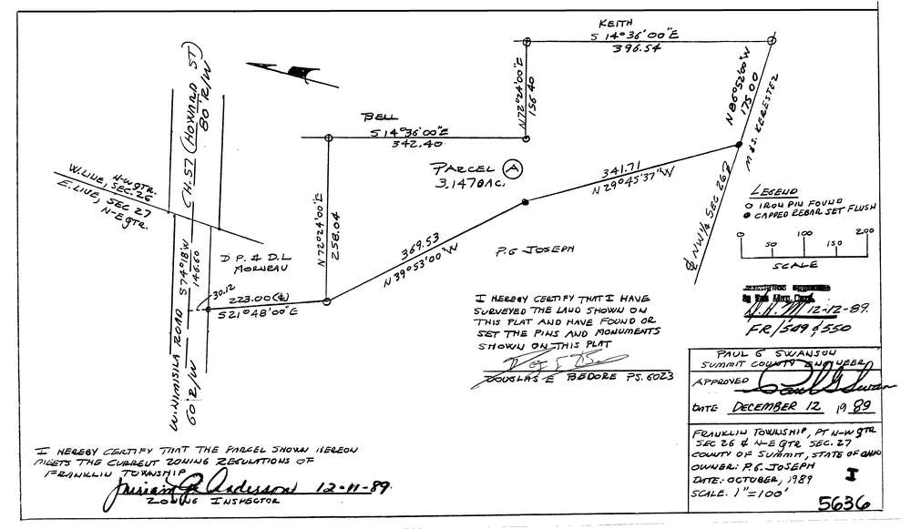
5636
Download lotsplits5636.tif
GIS Data
Latitude:
40.9342813999999
Longitude:
-81.5725012
Identification
Survey identifier:
5636
Context
Original township:
Franklin
Community list:
Franklin
Surveyed on:
10/01/1989
Description
Owner:
Joseph
Description:
Also In N.E. Qtr. Sec. 27
Primary road:
West Nimisila Rd
Secondary road:
Near intersection:
Manchester Rd
Acreage:
3.147
Survey Locators
Tract list:
Lot list:
Section list:
26
Quarter:
NW
Surveyor
Surveyor number:
6023
Surveyor name:
Bedore, Douglas E.
Company:
Bedore Surveying
Document Data
Scan File Name:
lotsplits5636.tif
Scan Pages:
1
Drawer location: