Toggle navigation
Survey Documents
Advanced Search
Supporting Data
Companies
Surveyors
Communities
Original Townships
APIs
Survey Documents API
Tutorial
About
Contact
Search
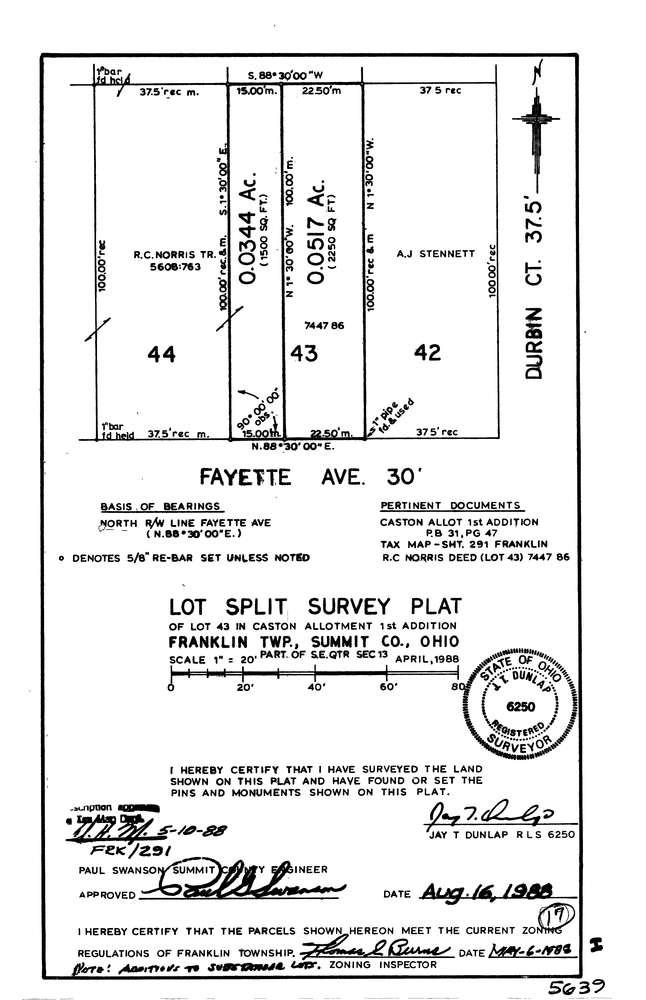
5639
Download lotsplits5639.tif
GIS Data
Latitude:
40.9616658999999
Longitude:
-81.5418348
Identification
Survey identifier:
5639
Context
Original township:
Franklin
Community list:
Franklin
Surveyed on:
05/16/1988
Description
Owner:
Description:
S/L 43 In Caston Allotment P.B. 31 Pg. 47
Primary road:
Fayette Ave
Secondary road:
Near intersection:
Durbin Court
Acreage:
0.1
Survey Locators
Tract list:
Lot list:
Section list:
13
Quarter:
SE
Surveyor
Surveyor number:
6250
Surveyor name:
Dunlap, Jay T.
Company:
Campbell & Associates
Document Data
Scan File Name:
lotsplits5639.tif
Scan Pages:
1
Drawer location: