Toggle navigation
Survey Documents
Advanced Search
Supporting Data
Companies
Surveyors
Communities
Original Townships
APIs
Survey Documents API
Tutorial
About
Contact
Search
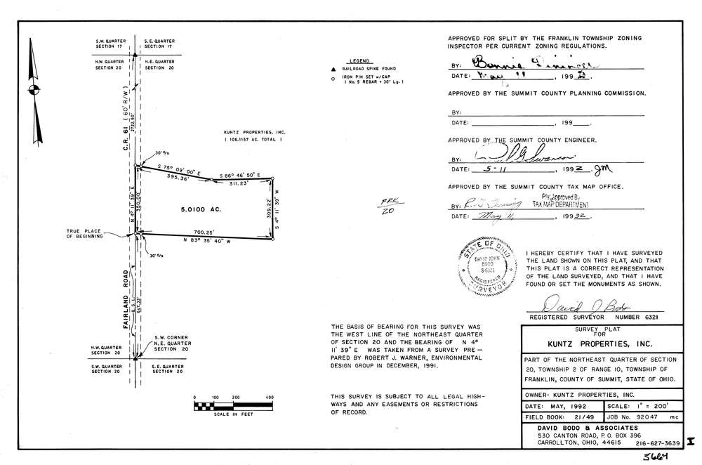
5664
Download lotsplits5664.tif
GIS Data
Latitude:
40.9521447999998
Longitude:
-81.6211275
Identification
Survey identifier:
5664
Context
Original township:
Franklin
Community list:
Franklin
Surveyed on:
05/01/1992
Description
Owner:
Kuntz Properties, Inc.
Description:
Primary road:
Fairland Rd
Secondary road:
Near intersection:
Center Rd
Acreage:
5.01
Survey Locators
Tract list:
Lot list:
Section list:
20
Quarter:
NE
Surveyor
Surveyor number:
6321
Surveyor name:
Bodo, David J.
Company:
Document Data
Scan File Name:
lotsplits5664.tif
Scan Pages:
1
Drawer location: