Toggle navigation
Survey Documents
Advanced Search
Supporting Data
Companies
Surveyors
Communities
Original Townships
APIs
Survey Documents API
Tutorial
About
Contact
Search
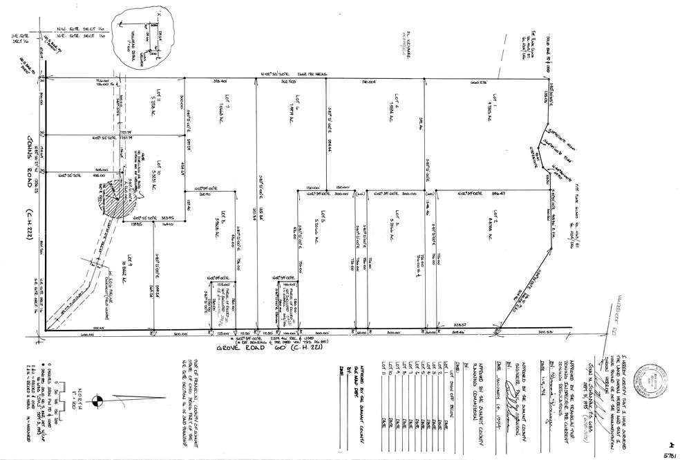
5781
Download lotsplits5781.tif
GIS Data
Latitude:
40.9669523999998
Longitude:
-81.5940759
Identification
Survey identifier:
5781
Context
Original township:
Franklin
Community list:
Franklin
Surveyed on:
09/03/1993
Description
Owner:
Description:
Primary road:
Grove Rd
Secondary road:
Johns Rd
Near intersection:
Acreage:
78.8
Survey Locators
Tract list:
Lot list:
Section list:
16
Quarter:
NE
Surveyor
Surveyor number:
6183
Surveyor name:
Johanyak, John M.
Company:
Document Data
Scan File Name:
lotsplits5781.tif
Scan Pages:
1
Drawer location: