Toggle navigation
Survey Documents
Advanced Search
Supporting Data
Companies
Surveyors
Communities
Original Townships
APIs
Survey Documents API
Tutorial
About
Contact
Search
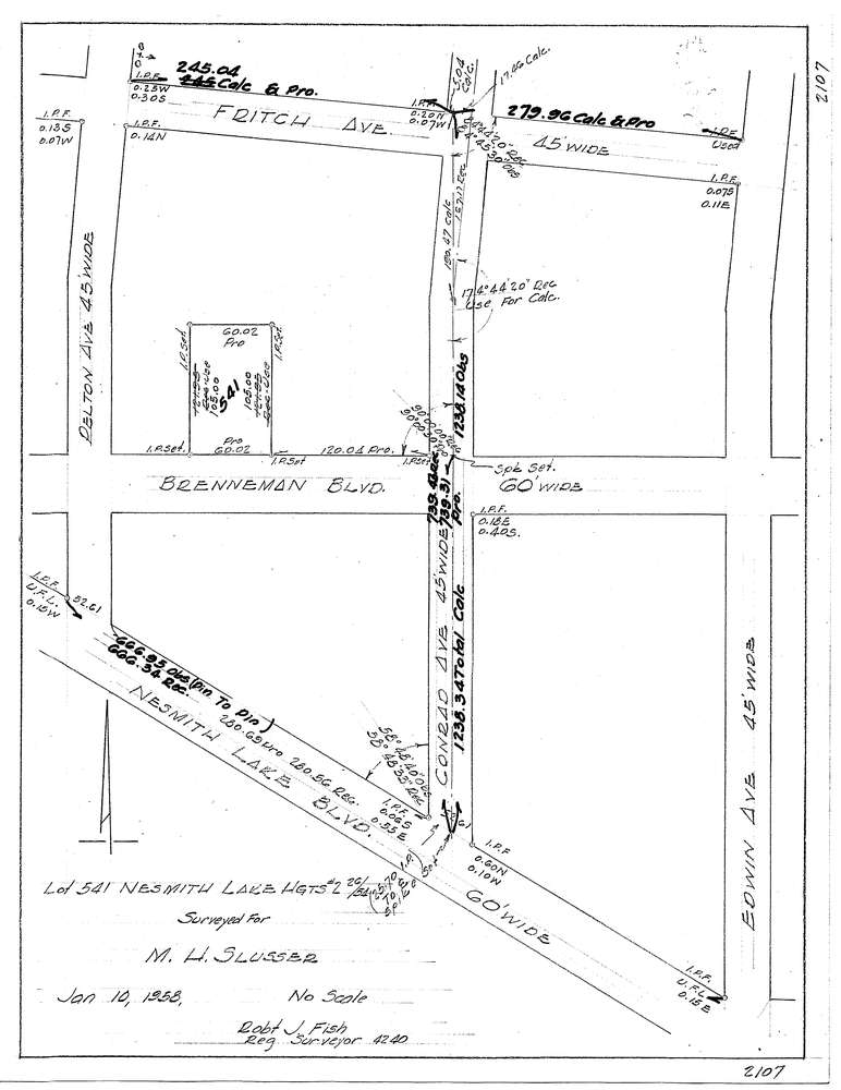
3127-3
Download f2107.tif
GIS Data
Latitude:
41.0273039999999
Longitude:
-81.544878
Identification
Survey identifier:
3127-3
Context
Original township:
Akron
Community list:
Akron
Surveyed on:
01/10/1958
Description
Owner:
Slusser
Description:
Lot 541 Nesmith Lake Hgts #2
Primary road:
Brenneman Blvd
Secondary road:
Conrad Ave
Near intersection:
Nesmith Lake Blvd
Acreage:
Survey Locators
Tract list:
Lot list:
Section list:
Quarter:
Surveyor
Surveyor number:
4240
Surveyor name:
Fish, Robert J.
Company:
Document Data
Scan File Name:
f2107.tif
Scan Pages:
1
Drawer location: