Toggle navigation
Survey Documents
Advanced Search
Supporting Data
Companies
Surveyors
Communities
Original Townships
APIs
Survey Documents API
Tutorial
About
Contact
Search
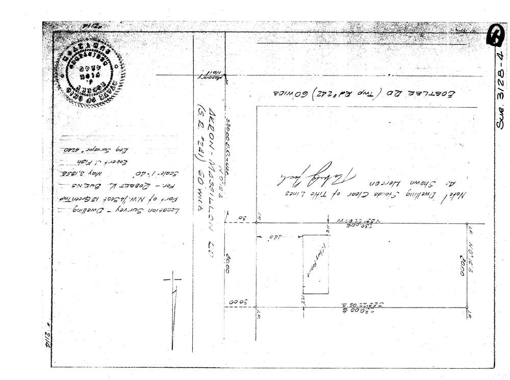
3128-4
Download lotsplits3128_4.tif
GIS Data
Latitude:
40.9597429999998
Longitude:
-81.466112
Identification
Survey identifier:
3128-4
Context
Original township:
Green
Community list:
Green
Surveyed on:
05/03/1958
Description
Owner:
Burns
Description:
Part Of N.W. 1/4 Section 15
Primary road:
Akron Massillon Rd
Secondary road:
Near intersection:
Boettler Rd
Acreage:
Survey Locators
Tract list:
Lot list:
Section list:
15
Quarter:
NW
Surveyor
Surveyor number:
4240
Surveyor name:
Fish, Robert J.
Company:
Document Data
Scan File Name:
lotsplits3128_4.tif
Scan Pages:
1
Drawer location: