Toggle navigation
Survey Documents
Advanced Search
Supporting Data
Companies
Surveyors
Communities
Original Townships
APIs
Survey Documents API
Tutorial
About
Contact
Search
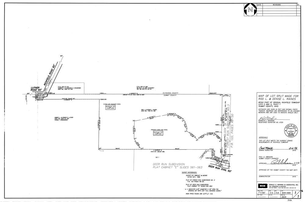
5836
Download lotsplits5836.tif
GIS Data
Latitude:
41.2766449999998
Longitude:
-81.656957
Identification
Survey identifier:
5836
Context
Original township:
Richfield
Community list:
Richfield
Surveyed on:
03/07/1995
Description
Owner:
Raines
Description:
Primary road:
Richfield Rd
Secondary road:
Deer Run Oval
Near intersection:
Luther Rd
Acreage:
22.9508
Survey Locators
Tract list:
1
Lot list:
2, 3
Section list:
Quarter:
Surveyor
Surveyor number:
6720
Surveyor name:
Bohning, Kenneth L.
Company:
Donald G. Bohning & Associates, Inc.
Document Data
Scan File Name:
lotsplits5836.tif
Scan Pages:
1
Drawer location: