Toggle navigation
Survey Documents
Advanced Search
Supporting Data
Companies
Surveyors
Communities
Original Townships
APIs
Survey Documents API
Tutorial
About
Contact
Search
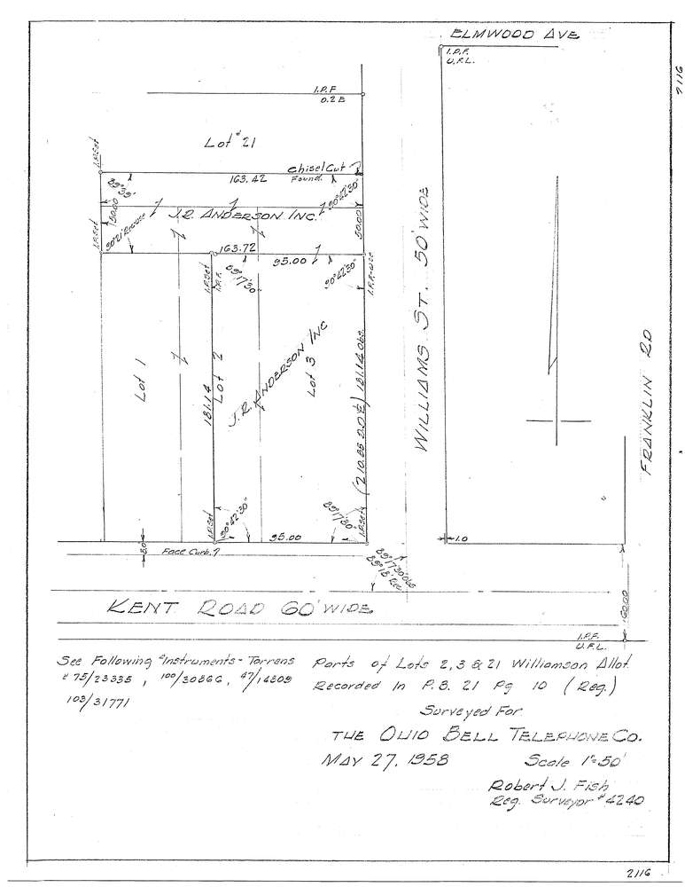
3129-2
Download f2116.tif
GIS Data
Latitude:
41.1599729999999
Longitude:
-81.438539
Identification
Survey identifier:
3129-2
Context
Original township:
Stow
Community list:
Stow
Surveyed on:
05/27/1958
Description
Owner:
Ohio Bell Telephone
Description:
Parts Of Lots 2, 3 And 21 Williamson Allotment
Primary road:
Kent Rd
Secondary road:
Near intersection:
Williams St
Acreage:
Survey Locators
Tract list:
Lot list:
Section list:
Quarter:
Surveyor
Surveyor number:
4240
Surveyor name:
Fish, Robert J.
Company:
Document Data
Scan File Name:
f2116.tif
Scan Pages:
1
Drawer location: