Toggle navigation
Survey Documents
Advanced Search
Supporting Data
Companies
Surveyors
Communities
Original Townships
APIs
Survey Documents API
Tutorial
About
Contact
Search
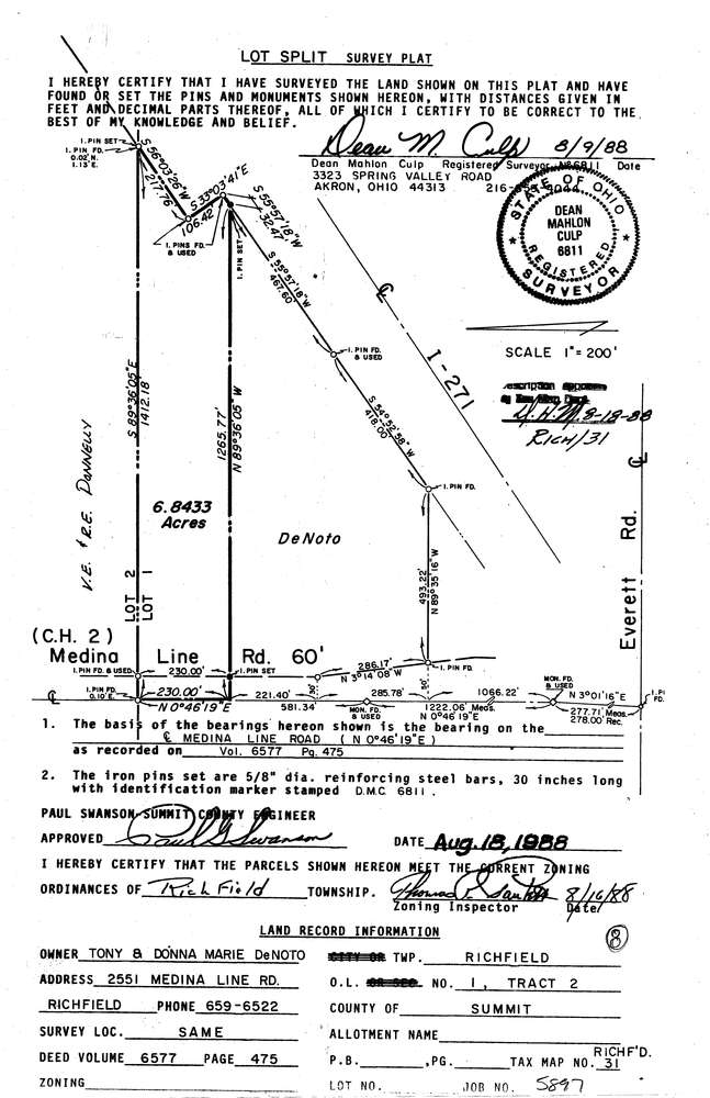
5897
Download lotsplits5897.tif
GIS Data
Latitude:
41.2076539999999
Longitude:
-81.677127
Identification
Survey identifier:
5897
Context
Original township:
Richfield
Community list:
Richfield
Surveyed on:
08/09/1988
Description
Owner:
Description:
Primary road:
Medina Line Rd
Secondary road:
I 271
Near intersection:
Everett Rd
Acreage:
6.8433
Survey Locators
Tract list:
2
Lot list:
1
Section list:
Quarter:
Surveyor
Surveyor number:
6811
Surveyor name:
Culp, Dean M.
Company:
Document Data
Scan File Name:
lotsplits5897.tif
Scan Pages:
1
Drawer location: