Toggle navigation
Survey Documents
Advanced Search
Supporting Data
Companies
Surveyors
Communities
Original Townships
APIs
Survey Documents API
Tutorial
About
Contact
Search
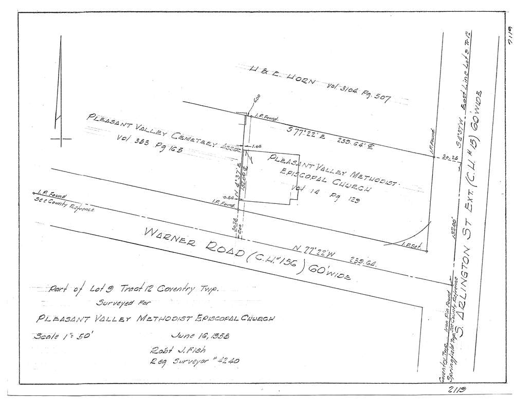
3129-4
Download f2119.tif
GIS Data
Latitude:
41.0062489999998
Longitude:
-81.49243
Identification
Survey identifier:
3129-4
Context
Original township:
Coventry
Community list:
Coventry
Surveyed on:
06/16/1958
Description
Owner:
Pleasant Valley Methodist
Description:
Primary road:
South Arlington St
Secondary road:
Near intersection:
Warner Rd
Acreage:
Survey Locators
Tract list:
12
Lot list:
9
Section list:
Quarter:
Surveyor
Surveyor number:
4240
Surveyor name:
Fish, Robert J.
Company:
Document Data
Scan File Name:
f2119.tif
Scan Pages:
1
Drawer location: