Toggle navigation
Survey Documents
Advanced Search
Supporting Data
Companies
Surveyors
Communities
Original Townships
APIs
Survey Documents API
Tutorial
About
Contact
Search
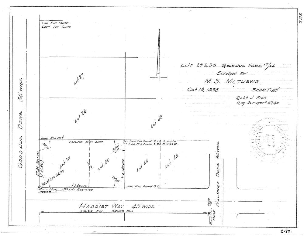
3130-4
Download f2129.tif
GIS Data
Latitude:
41.1164939999999
Longitude:
-81.580739
Identification
Survey identifier:
3130-4
Context
Original township:
Akron
Community list:
Akron
Surveyed on:
10/18/1958
Description
Owner:
Mathews
Description:
Lots 29, 30 Goodhue Park
Primary road:
Harriet Way
Secondary road:
Goodhue Dr
Near intersection:
Wasldorf Dr
Acreage:
Survey Locators
Tract list:
Lot list:
Section list:
Quarter:
Surveyor
Surveyor number:
4240
Surveyor name:
Fish, Robert J.
Company:
Document Data
Scan File Name:
f2129.tif
Scan Pages:
1
Drawer location: