Toggle navigation
Survey Documents
Advanced Search
Supporting Data
Companies
Surveyors
Communities
Original Townships
APIs
Survey Documents API
Tutorial
About
Contact
Search
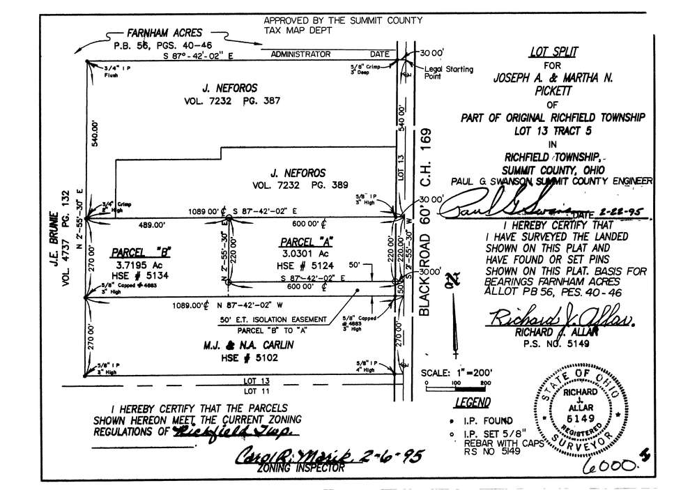
6000
Download lotsplits6000.tif
GIS Data
Latitude:
41.2656789999998
Longitude:
-81.609964
Identification
Survey identifier:
6000
Context
Original township:
Richfield
Community list:
Richfield
Surveyed on:
02/22/1995
Description
Owner:
Pickett
Description:
Farnham Acres Allotment P.B.56 Pg. 40 46
Primary road:
Black Rd
Secondary road:
Near intersection:
Ohio Turnpike
Acreage:
3.0301
Survey Locators
Tract list:
5
Lot list:
13
Section list:
Quarter:
Surveyor
Surveyor number:
5149
Surveyor name:
Allar, Richard J.
Company:
Document Data
Scan File Name:
lotsplits6000.tif
Scan Pages:
1
Drawer location: