Toggle navigation
Survey Documents
Advanced Search
Supporting Data
Companies
Surveyors
Communities
Original Townships
APIs
Survey Documents API
Tutorial
About
Contact
Search
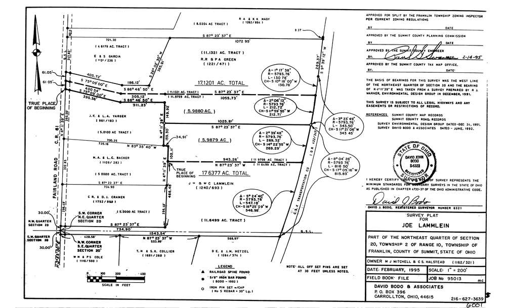
6001
Download lotsplits6001.tif
GIS Data
Latitude:
40.9520424999998
Longitude:
-81.6183918
Identification
Survey identifier:
6001
Context
Original township:
Franklin
Community list:
Franklin
Surveyed on:
02/01/1995
Description
Owner:
Miitchell & Halstead
Description:
Primary road:
Fairland Rd
Secondary road:
Near intersection:
Center Rd
Acreage:
34.7579
Survey Locators
Tract list:
Lot list:
Section list:
20
Quarter:
NE
Surveyor
Surveyor number:
6321
Surveyor name:
Bodo, David J.
Company:
David Bodo & Associates
Document Data
Scan File Name:
lotsplits6001.tif
Scan Pages:
1
Drawer location: