Toggle navigation
Survey Documents
Advanced Search
Supporting Data
Companies
Surveyors
Communities
Original Townships
APIs
Survey Documents API
Tutorial
About
Contact
Search
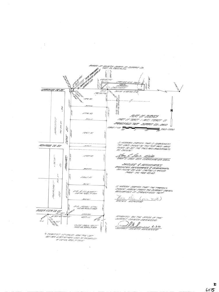
6075
Download lotsplits6075.tif
GIS Data
Latitude:
41.0054069999998
Longitude:
-81.483654
Identification
Survey identifier:
6075
Context
Original township:
Springfield
Community list:
Springfield
Surveyed on:
12/01/1990
Description
Owner:
Description:
Primary road:
Mallard Dr
Secondary road:
Near intersection:
Buena Vista Dr
Acreage:
5.9143
Survey Locators
Tract list:
1, 2
Lot list:
Section list:
Quarter:
Surveyor
Surveyor number:
5816
Surveyor name:
Lane, Gary E.
Company:
Shisler & Associates
Document Data
Scan File Name:
lotsplits6075.tif
Scan Pages:
1
Drawer location: