Toggle navigation
Survey Documents
Advanced Search
Supporting Data
Companies
Surveyors
Communities
Original Townships
APIs
Survey Documents API
Tutorial
About
Contact
Search
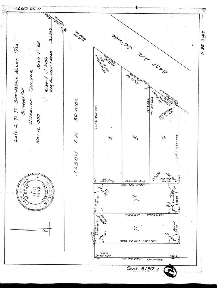
3137-1
Download lotsplits3137_1.tif
GIS Data
Latitude:
41.0545019999999
Longitude:
-81.56368
Identification
Survey identifier:
3137-1
Context
Original township:
Akron
Community list:
Akron
Surveyed on:
11/12/1959
Description
Owner:
Culver
Description:
Lots 6, 71, 72 Springdale Allotment
Primary road:
Jason Ave
Secondary road:
Near intersection:
East Ave
Acreage:
Survey Locators
Tract list:
Lot list:
Section list:
Quarter:
Surveyor
Surveyor number:
4240
Surveyor name:
Fish, Robert J.
Company:
Document Data
Scan File Name:
lotsplits3137_1.tif
Scan Pages:
1
Drawer location: