Toggle navigation
Survey Documents
Advanced Search
Supporting Data
Companies
Surveyors
Communities
Original Townships
APIs
Survey Documents API
Tutorial
About
Contact
Search
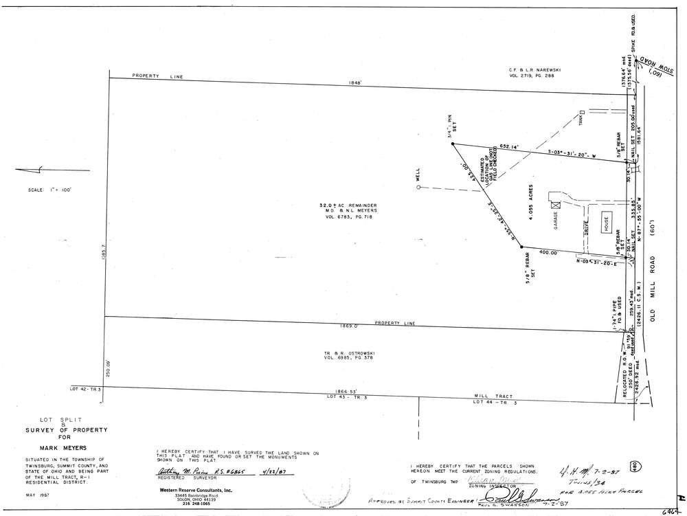
6464
Download lotsplits6464.tif
GIS Data
Latitude:
41.2857159999999
Longitude:
-81.41426
Identification
Survey identifier:
6464
Context
Original township:
Twinsburg
Community list:
Twinsburg
Surveyed on:
04/22/1987
Description
Owner:
Meyers
Description:
Primary road:
Old Mill Rd
Secondary road:
Near intersection:
Stow Rd
Acreage:
4.055
Survey Locators
Tract list:
MILL
Lot list:
Section list:
Quarter:
Surveyor
Surveyor number:
6865
Surveyor name:
Picone, Anthony M.
Company:
Western Reserve
Document Data
Scan File Name:
lotsplits6464.tif
Scan Pages:
1
Drawer location: