Toggle navigation
Survey Documents
Advanced Search
Supporting Data
Companies
Surveyors
Communities
Original Townships
APIs
Survey Documents API
Tutorial
About
Contact
Search
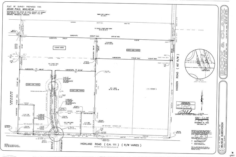
6467
Download lotsplits6467.tif
GIS Data
Latitude:
41.3000399999999
Longitude:
-81.461778
Identification
Survey identifier:
6467
Context
Original township:
Twinsburg
Community list:
Twinsburg
Surveyed on:
02/17/1994
Description
Owner:
Wilhelm
Description:
Primary road:
Highland Rd
Secondary road:
Hadden Rd
Near intersection:
Boyle Parkway
Acreage:
43.1141
Survey Locators
Tract list:
Lot list:
1
Section list:
Quarter:
Surveyor
Surveyor number:
6498
Surveyor name:
Clark, Kevin J.
Company:
Bock & Clark
Document Data
Scan File Name:
lotsplits6467.tif
Scan Pages:
1
Drawer location: