Toggle navigation
Survey Documents
Advanced Search
Supporting Data
Companies
Surveyors
Communities
Original Townships
APIs
Survey Documents API
Tutorial
About
Contact
Search
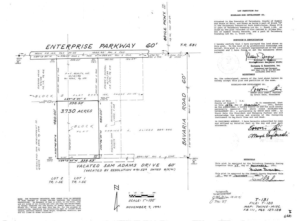
6480
Download lotsplits6480.tif
GIS Data
Latitude:
41.2901089999999
Longitude:
-81.464739
Identification
Survey identifier:
6480
Context
Original township:
Twinsburg
Community list:
Twinsburg
Surveyed on:
11/07/1991
Description
Owner:
Highland Som Development Co
Description:
Primary road:
Enterprise Parkway
Secondary road:
Near intersection:
Boyle Parkway
Acreage:
3.73
Survey Locators
Tract list:
Lot list:
1, 2
Section list:
Quarter:
Surveyor
Surveyor number:
4492
Surveyor name:
Dempsey, William J.
Company:
Dempsey & Neff, Inc.
Document Data
Scan File Name:
lotsplits6480.tif
Scan Pages:
1
Drawer location: