Toggle navigation
Survey Documents
Advanced Search
Supporting Data
Companies
Surveyors
Communities
Original Townships
APIs
Survey Documents API
Tutorial
About
Contact
Search
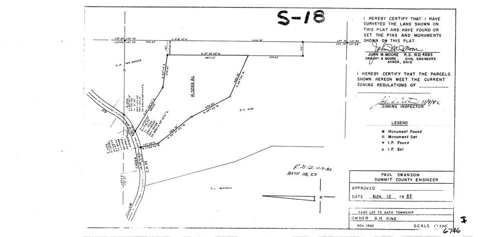
6746
Download lotsplits6746.tif
GIS Data
Latitude:
41.1540207999998
Longitude:
-81.6091901
Identification
Survey identifier:
6746
Context
Original township:
Bath
Community list:
Bath
Surveyed on:
11/01/1982
Description
Owner:
King
Description:
Primary road:
Yellow Creek Rd
Secondary road:
Near intersection:
Revere Rd
Acreage:
14.5269
Survey Locators
Tract list:
Lot list:
73
Section list:
Quarter:
Surveyor
Surveyor number:
4883
Surveyor name:
Moore, John M.
Company:
Swigart & Moore
Document Data
Scan File Name:
lotsplits6746.tif
Scan Pages:
1
Drawer location: