Toggle navigation
Survey Documents
Advanced Search
Supporting Data
Companies
Surveyors
Communities
Original Townships
APIs
Survey Documents API
Tutorial
About
Contact
Search
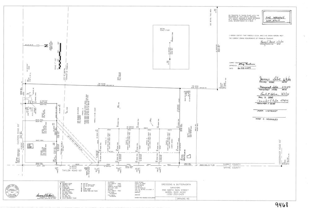
9468
Download lotsplits9468.tif
GIS Data
Latitude:
40.9857305999998
Longitude:
-81.6459978
Identification
Survey identifier:
9468
Context
Original township:
Franklin
Community list:
Franklin
Surveyed on:
09/01/2002
Description
Owner:
Pine Meadows Developers
Description:
Primary road:
Taylor Rd
Secondary road:
Near intersection:
Eastern Rd
Acreage:
32.0727
Survey Locators
Tract list:
Lot list:
6
Section list:
7
Quarter:
Surveyor
Surveyor number:
5916
Surveyor name:
Butterworth, Lawrence L.
Company:
Greissing & Butterworth
Document Data
Scan File Name:
lotsplits9468.tif
Scan Pages:
1
Drawer location: