Toggle navigation
Survey Documents
Advanced Search
Supporting Data
Companies
Surveyors
Communities
Original Townships
APIs
Survey Documents API
Tutorial
About
Contact
Search
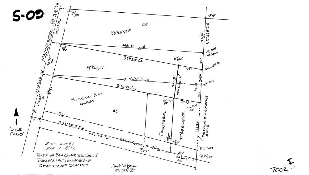
7002
Download lotsplits7002.tif
GIS Data
Latitude:
40.9745576999998
Longitude:
-81.5624612
Identification
Survey identifier:
7002
Context
Original township:
Franklin
Community list:
Franklin
Surveyed on:
06/11/1981
Description
Owner:
Description:
Primary road:
Swigart Rd
Secondary road:
Near intersection:
Manchester Rd
Acreage:
Survey Locators
Tract list:
Lot list:
Section list:
11
Quarter:
SW
Surveyor
Surveyor number:
5342
Surveyor name:
Bell, Jack W.
Company:
Document Data
Scan File Name:
lotsplits7002.tif
Scan Pages:
1
Drawer location: