Toggle navigation
Survey Documents
Advanced Search
Supporting Data
Companies
Surveyors
Communities
Original Townships
APIs
Survey Documents API
Tutorial
About
Contact
Search
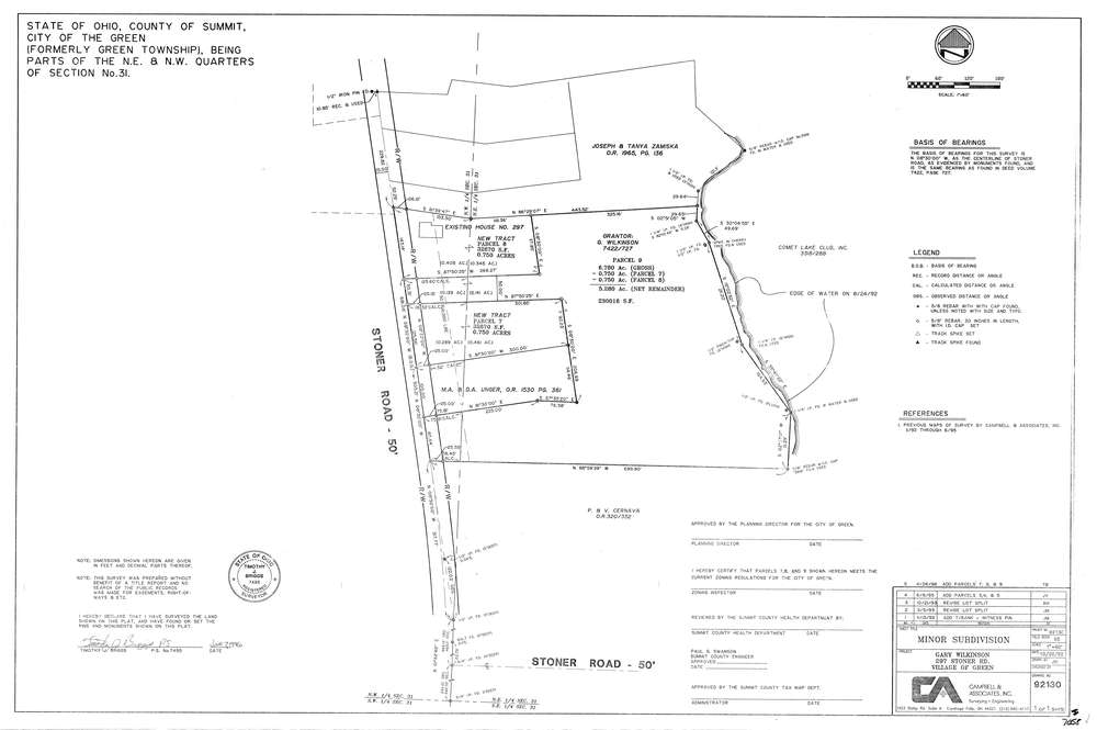
7058
Download lotsplits7058.tif
GIS Data
Latitude:
40.9207216999998
Longitude:
-81.5248925
Identification
Survey identifier:
7058
Context
Original township:
Green
Community list:
Green
Surveyed on:
06/07/1996
Description
Owner:
Wilkinson
Description:
Primary road:
Stoner Rd
Secondary road:
Near intersection:
Acreage:
6.78
Survey Locators
Tract list:
Lot list:
Section list:
31
Quarter:
NE
Surveyor
Surveyor number:
7495
Surveyor name:
Briggs, Timothy J.
Company:
Campbell & Associates
Document Data
Scan File Name:
lotsplits7058.tif
Scan Pages:
1
Drawer location: