Toggle navigation
Survey Documents
Advanced Search
Supporting Data
Companies
Surveyors
Communities
Original Townships
APIs
Survey Documents API
Tutorial
About
Contact
Search
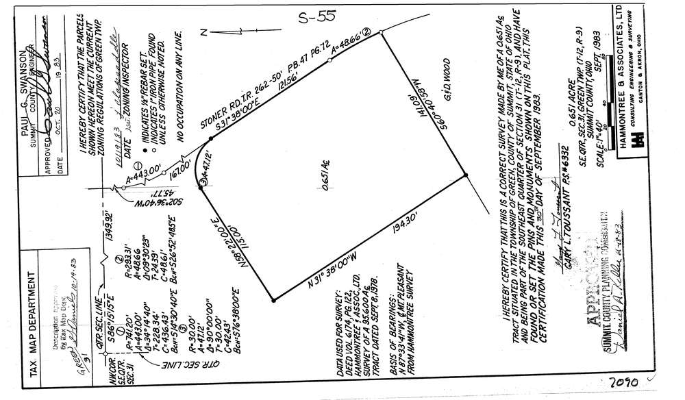
7090
Download lotsplits7090.tif
GIS Data
Latitude:
40.9150138999999
Longitude:
-81.5205657
Identification
Survey identifier:
7090
Context
Original township:
Green
Community list:
Green
Surveyed on:
11/01/1983
Description
Owner:
Description:
Primary road:
Stoner Rd
Secondary road:
Near intersection:
Acreage:
0.651
Survey Locators
Tract list:
Lot list:
Section list:
31
Quarter:
SE
Surveyor
Surveyor number:
6332
Surveyor name:
Toussant, Gary L.
Company:
Hammontree & Associates
Document Data
Scan File Name:
lotsplits7090.tif
Scan Pages:
1
Drawer location: